Hachimantai Hill climbing(B-8) ⭐⭐⭐⭐ ‘23.17th,June
This E-8 route is in Area-B “Tohoku". See Area-B map/ See Japan map
Sight & Entertainment ⭐⭐⭐⭐
Food & Drinks ⭐⭐⭐⭐
Easiness ⭐
Road Condition ⭐⭐⭐
Safety ⭐⭐⭐
The wet season has already started but weather forecast had told us it would be fine in that week end, so I booked the Shinkansen tickets and hotel at Morioka city and implemented my long suspended tough hill climbing tour.
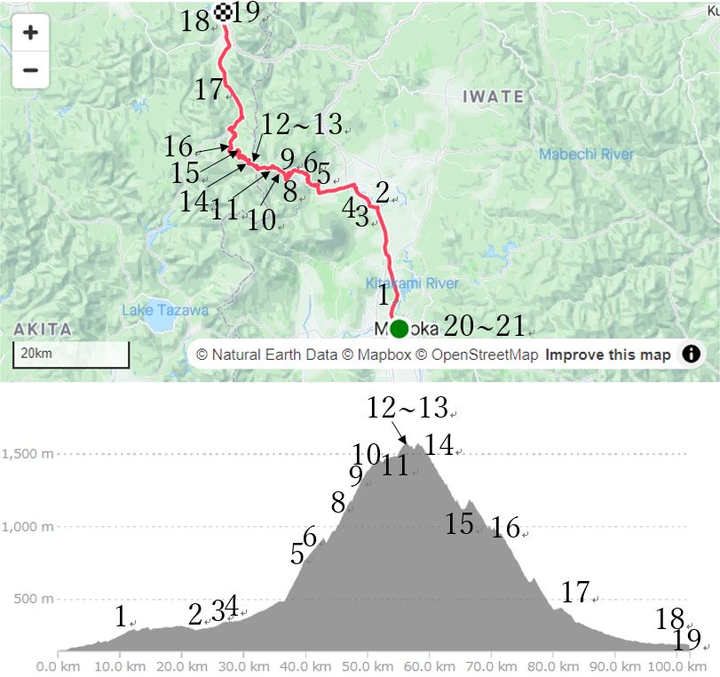
Reaching at Morioka station at AM8:44, I dropped off extra clothes at my hotel, and started at AM9:15. Since it was rainy last night, still there were clouds over the Iwaki mountain(pic.1). After 20km cycling on the busy Route-4, now the course changed toward Hachimantai hills(pic.2).
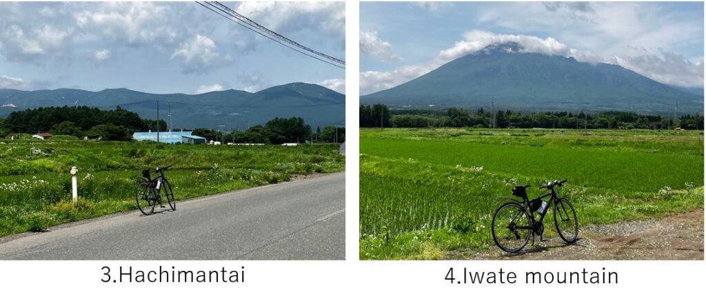
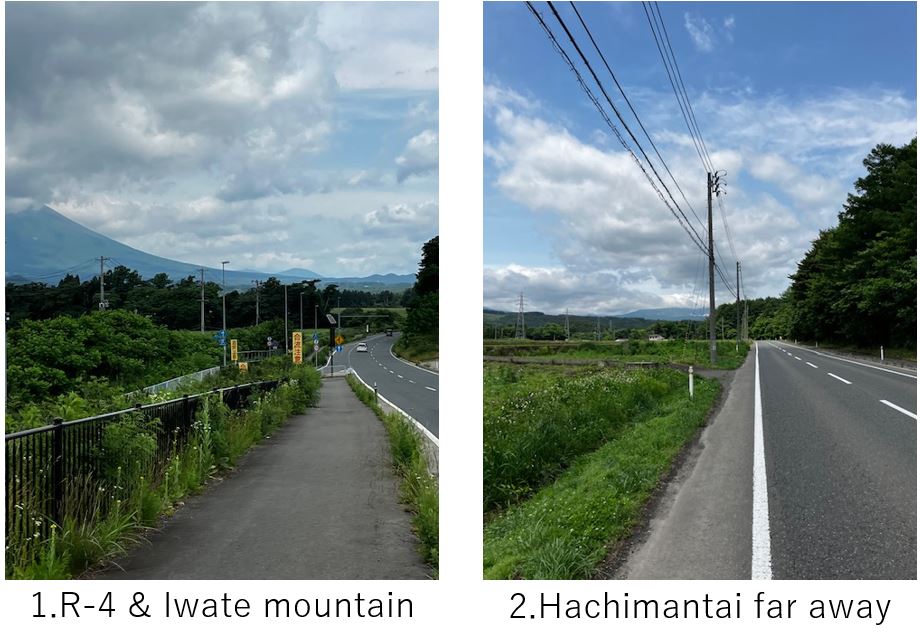
The clouds were gradually cleared and the hills came closer(pic.4) and Iwate mountain also can be seen clearly in an idyllic farm scene(pic.4). When the route turned right at the entrance of Hachimantai hot spring village, the hill climbing started.
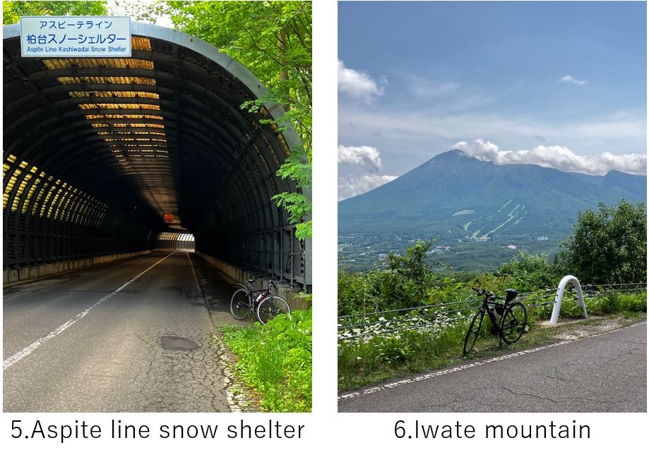
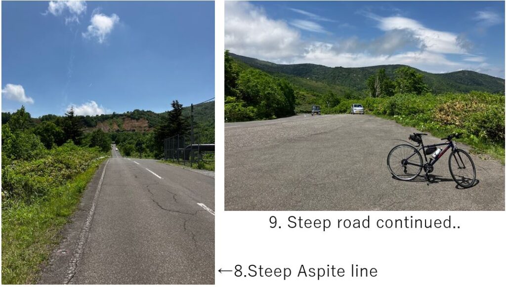
This route is called “Aspite line" which is famous for the snow wall on both sides of the route in spring season. So there were many snow shelters to keep safe against avalanche(pic.5), in which I was always fighting with the uphill slope. If you want to see the snow wall, it’ll be better to visit in April or early May.
The spot of pic.6 was the last chance to take a Iwate mountain pic. The height was already around 1000M but still I had room. But after that, when I passed the last snow shelter, the slope seemed much steeper for me(pic.8). My speed drastically slowed down.
After 1100M height, I took a short rest many times(pic.9) and my leg cramped several times and I had to push my bike for tens of meters each time.

Above the Pic.10 point, the fog(gas) blew strongly. The hill top seemed to come closer.
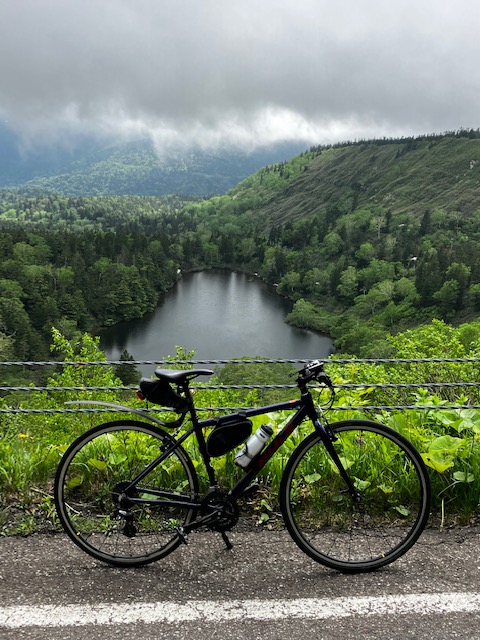
Suddenly a beautiful scenery opened up and a big pond(pic.11) caught my eye. So I stopped my bike even though it was in the middle of the slope. Again I got my leg cramped.
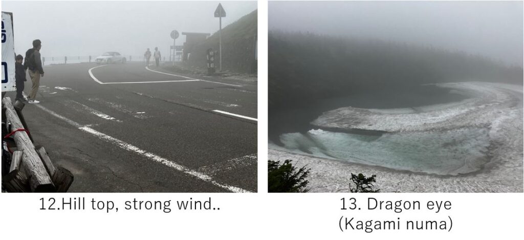
After reaching the ridge of hill, the slope became gentle but the visibility got worse due to deep fog and strong head wind blew. Finally I reached Mikaeri-touge(pass) (pic.12) at PM2:00. Two hours later than my expectation.
Here there is a very famous pond, Dragon eye 300M away from the parking. In June, the lower land is already warm or hot but the snow remained in this high mountain area. So I could recognize the shape of dragon eye(pic.13) a little. If there is no fog, it might have been much beautiful, though the timing was a little late in this year.
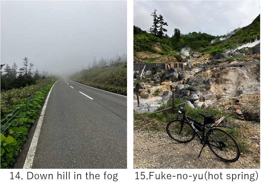
Now I could expect only down hill. It was so cool on the top of hill (below 10C) that I started wearing wind breaker after warming my body in front of heater. The route was a little dangerous since I could not see forward due to the fog(pic.14).
But of course it was easy riding since it was almost only down hill. I came down to 1000M height in a moment and reached my coveted hot spring, Fuke-no-yu(pic.15), secret muddy hot spring. Since my train to returning to Morioka was PM6:36, I thought I would have enough time to dip in. But unfortunately day trippers can enter just before PM3:00 and it was PM3:15. So I only took the pic of the scene of hot spring area(pic.15) and continued cycling.
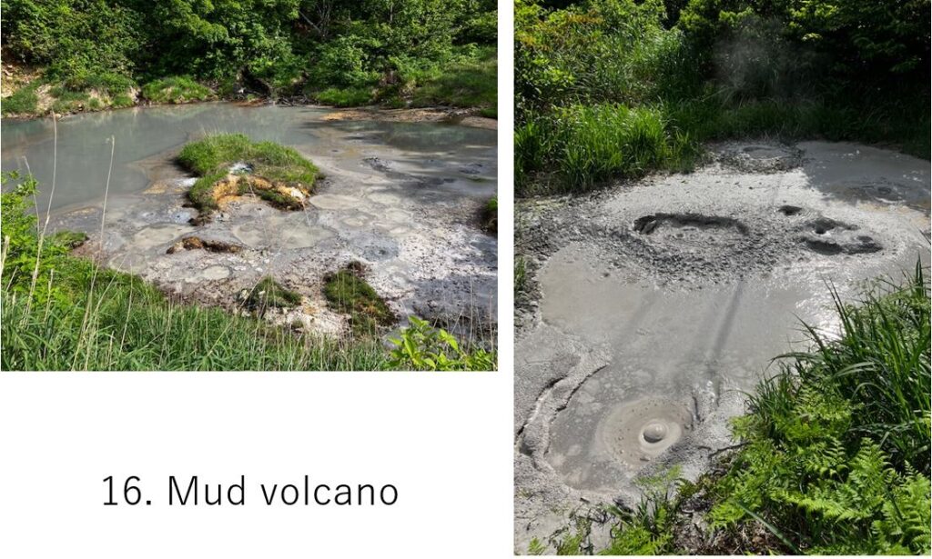
There were several similar hot springs in this area. The Mud volcano, 200M below the Fuke-no-yu, was also such kind of spring(pic.16). The mud sometimes leaps a little by springing up gas.
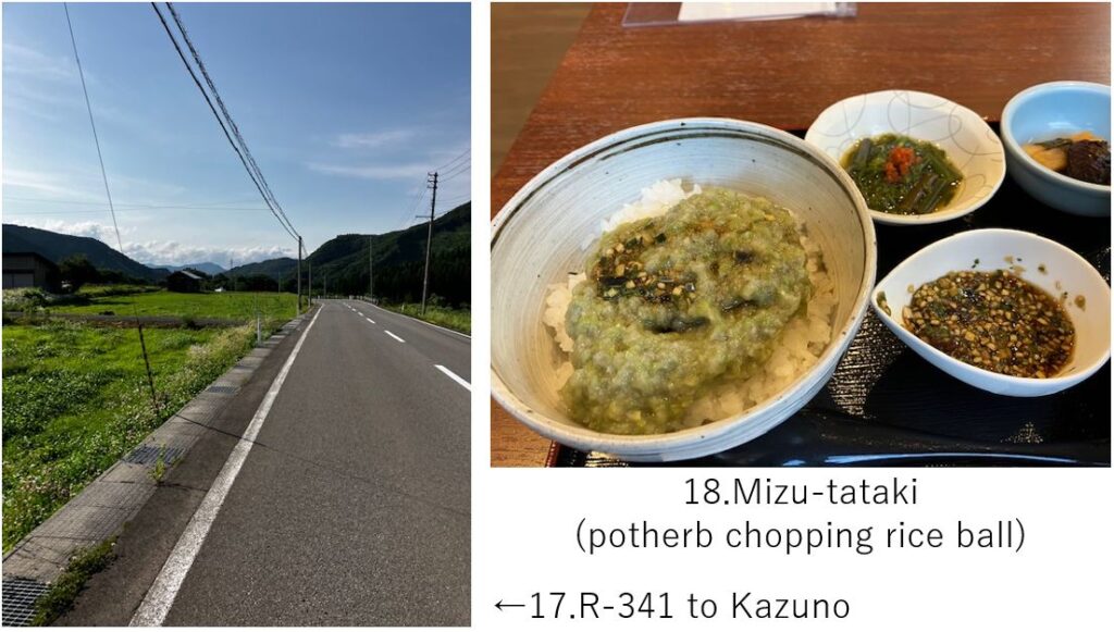
Finally a comfy downhill ended and turned right to R-341(pic.17). The rural road continued over 20km w/ seeing very few cars. It was PM5:00 when I reached Kazuno city. I got a little hungry so I dropped in a road side station “Kazuno" and ordered local cuisine, Mizu(potherb)-tataki(chopping) rice ball(pic.18). This Mizu is a special herb produced in this area and it was completely vegan cuisine. The taste was very nice for tired body.
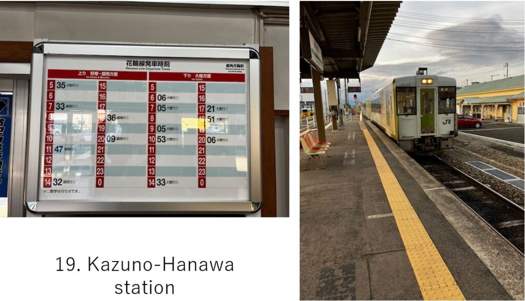
I wish the train has run more frequently(pic.19) but it’s common in rural area. From here to Morioka station, it took 2hours, so I reached Morioka hotel at PM9:00.
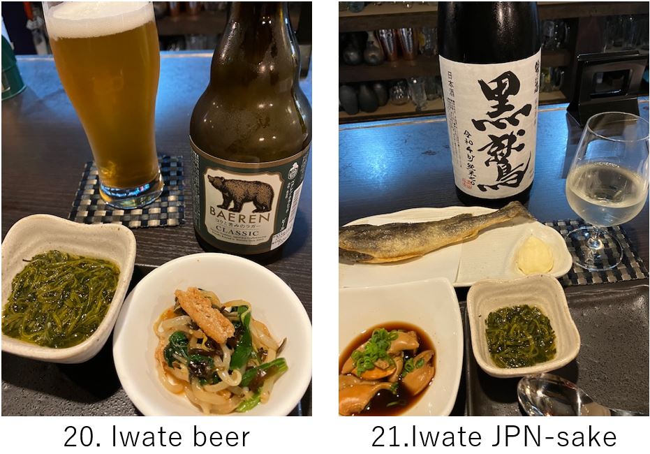
Now my 2nd main event, going to local Japanese Sake bar! I had already had my eyes on one bar, “Nihonshu Baru, Haru" and went straight there in a busy area. First I ordered a local beer “BAEREN" whose taste was bitter lager and then ordered 4 types of Iwate’s sake.
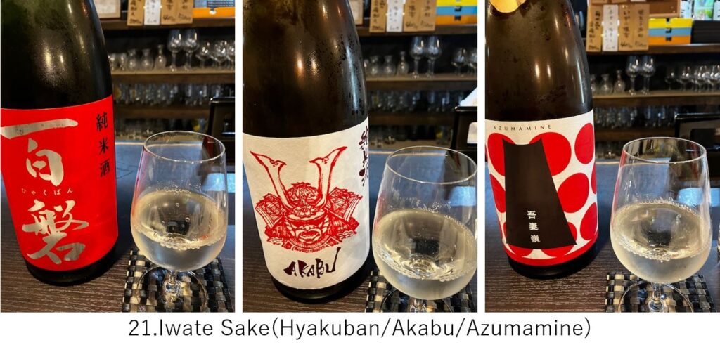
Unfortunately I could not enjoy local agricultural foods but instead I could enjoy talking with a young neighbor who studied in Iwate university. It’s my purpose and way to enjoy local sake with cycling!
<Transportation info>
From Tokyo to Morioka: AM6:32 start at Tokyo, Tohoku Shinkansen “Hayabusa" No.1, AM8:44 arrival at Morioka. \15,010-
<Other recommended spots near my route>
Pls check “Iwate prefecture" 's guide web site
<Connected route>
B-9: Morioka to Hiraizumi