Yamanami highway to Mt.Aso(I-2)⭐⭐⭐⭐⭐ ‘25.30th,Mar
This route I-2 is in Area-I “Kyushu". See Area-I map/ See Japan map
Sight & Entertainment ⭐⭐⭐⭐⭐
Food & Drinks ⭐⭐⭐⭐
Easiness ⭐
Road conditions ⭐⭐⭐⭐
Safety ⭐⭐⭐
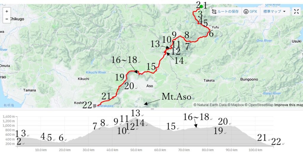
When I went to bed last night, I was afraid of the pain behind my knee remaining in next morning but it became real. I woke up at AM5:30 and started cycling at AM6:40 with pain(pic.1). It was almost sunny but very cold in its spring season.
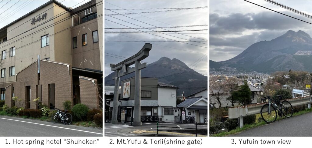
I took a breakfast at a conveient store from which I could see Mt.Yufu and big Torii(pic.2). Then resumed cycling toward mountain. Soon I climbed to a small hill from which Yufuin city and Mt.Yugu could be seen(pic.3).
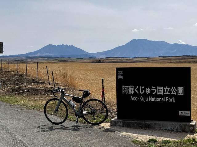
But soon the road started down hill over 10km. Since I missed the road yesterday, I was very nervous about finding a junction. The first junction was easy to find and I crossed the bridge where a forlorn prefectural R-537 started toward inner mountain(pic.4).
Soon after a little hill climb, again gentle down slope continued for a while but again I had to search a small junction toward a farm road to avoid long detour to prefectural R-621. I successfully found a narrow farm roads which short cut toward R-621 but suddenly steeper hill climbing started(pic.6). I had estimated that I had to climb over 2000m cumulatively in this day, so I pushed the gear to lowest from the beginning to save my power and protect my back knee.
But as I repeated shifting from high gear to low one many times, suddenly the front gear stopped reacting in the midst of climbing. Soon after that, the rear gear also stopped reacting. My mind went blank! Fortunately the shift position was lower side, I could continue climbing. I thought the battery went empty at that time but when I went to see bike shop after returning Tokyo, the gear software had malfunction.
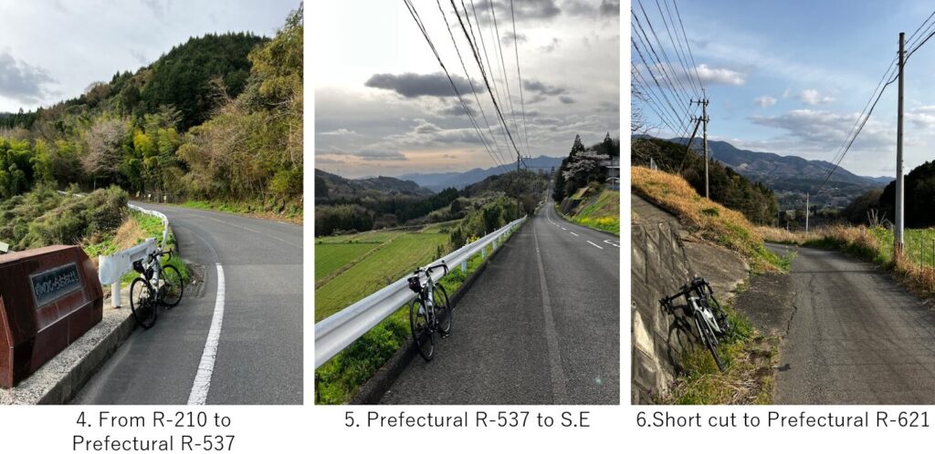
I took many rests in the middle of the 10km slope before finding a cozy Kurodake Cafe. I ordered black tea and their water was drawn from a near spring Oike, selected as Japanese top 100 best water, so the taste was amazingly good. I could heal my fatigue a little. I expected the climbing would end soon and asked the madam when the climbing would end, but her answer was disappointing.
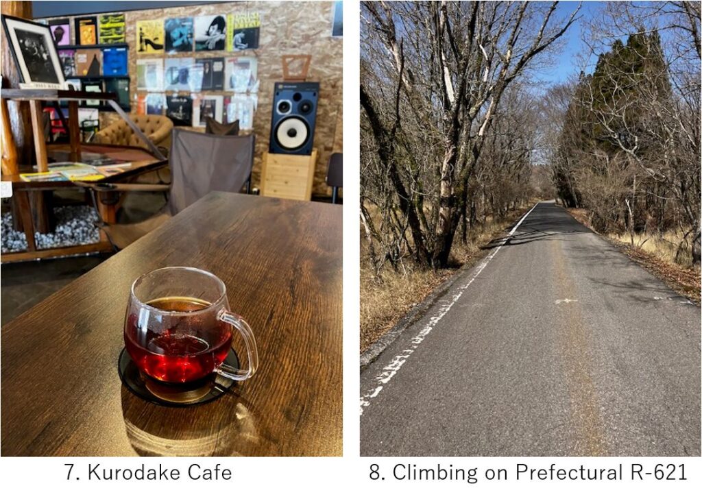
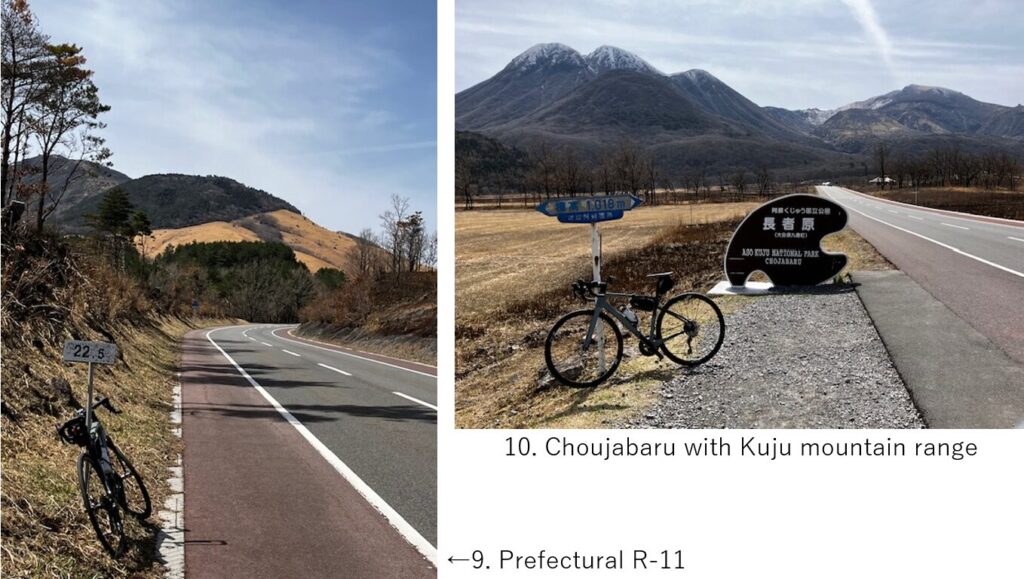
I had to climb a steep up hill again for 4-5km without any spectacle(pic.8), and finally I reached Prefectural R-11, known as “Yamanami high way“(pic.9). From there down slope started toward “Choujabaru“(pic.10). The season was early Spring, so as the custom of this area, burning the dead grass in the field had just finished, but maybe in real Spring or beginning of Summer, the spectacle must be so nice.
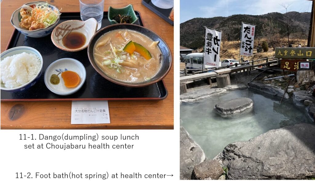
It was sunny but due to the altitude, I felt cold. And since the time was AM11:30, I took lunch in the Choujabaru health center which had a foot bath in front of the building(pic.11-2). I ordered a local lunch menu(pic.11-1) with which a miso based soup with dumpling. It warmed my cold body.
After 30min rest there, I resumed cycling. Outside coldness made me shivering but hill climbing again made me warm. I braced myself to over 500m climbing to pass the Kuju mountain range but when I checked the route, it seemed less than 300m, which made me cheerful since I’d alread climbed over 1000m so far, so 300m seemed a small obstacle.
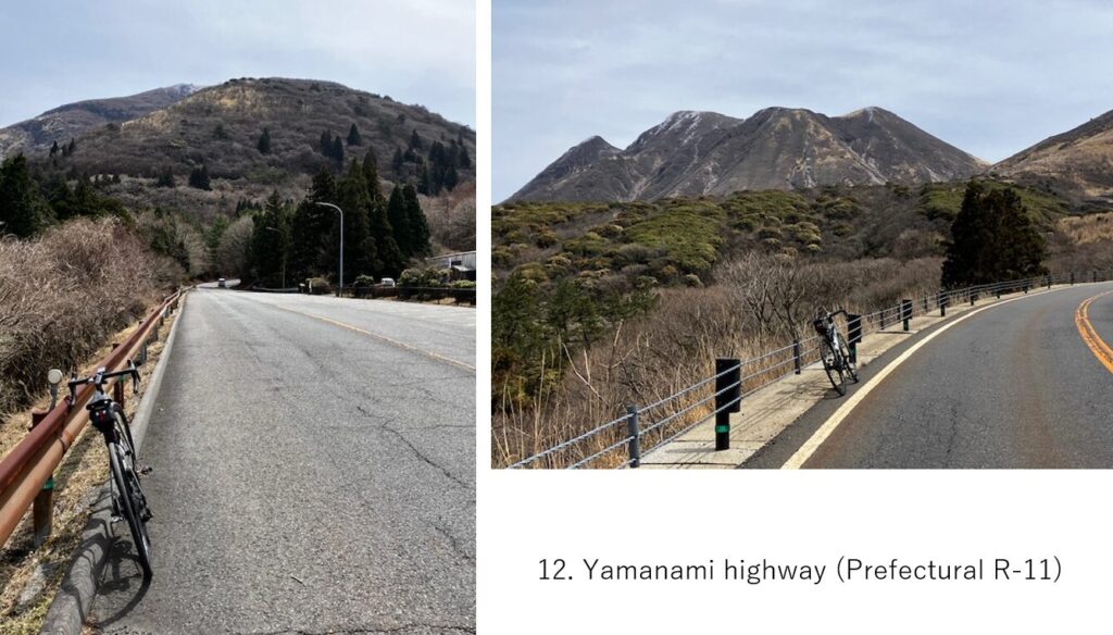
The road was wide and nice(pic.12). Though I took rests when I felt pain or tired, I don’t have bad impression in this R-11. Within 8km from the lunch space, I could reach Makinoto pass rest house(pic.13). I didn’t take a long rest there since I knew there should be down hill from that point.
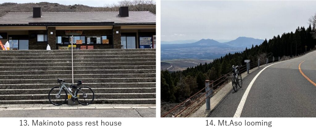
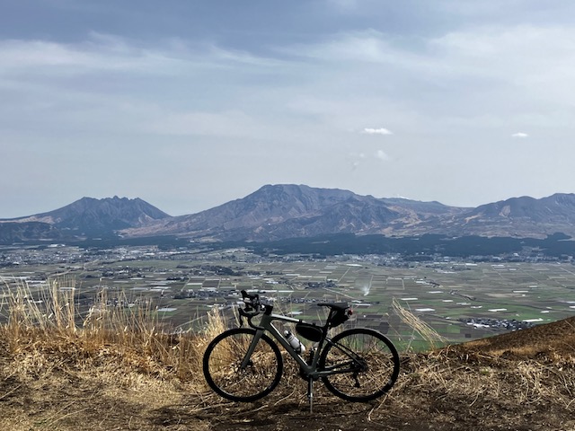
Soon after the rest house, Mt.Aso came to my sight(pic.14). Due to the broken gear, I could not speed up at the flat road but could do in a long down hill. It must be very comfortable in warm season, but this day was abnormally cold, so I prefered a slight hill climb in such a high altitude.
Once the down slope ended at “Senomoto rest house", the road with slight up and down on the Kuju national park plateau continued(pic.15). It was also in a high mountain, the strong North-West wind felt very cold. But the road condition was still nice.
Finally I reached the edge of the outer rim mountain of Mt.Aso’s caldera. Japan archipelago, especially Kyushu island has many caldera terrains. Among those calderas, Mt.Aso is the most famous one. It was my first visit to Mt.Aso, which was overwhelming.
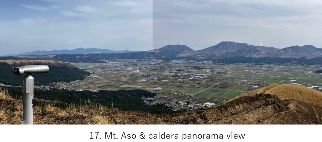
Of course I took enough time to enjoy the panorama view, so I walked to the edge of observatory(pic.17), though the cold strong wind blew me. Fortunately the volcano took rest recently, just a small smoke could be seen.
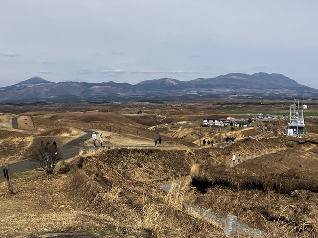
Kuju mountain range and plateau could be seen North side of the observatory(pic.18).
The time PM2:45 and according to my original plan, I must go to Kusasenri-gahama. But I felt much heavier pain at back knee, and my gear broken, so I had to give up visiting there which required another 500m hill climbing, so I decided to go directly to hotel along the outer rim mountain.
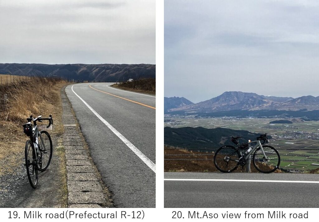
Still I felt chilly, I resumed cycling on the Milk road(pic.19). Sometimes I could watch Mt.Aso in my left hand side(pic.20).
When the road came to the break point of outer rim mountains from which the caldera lake water spilled toward west coast of Kyushu island around 100k years ago, suddenly steep down hill started. I even felt fear with the high speed in a meandering narrow road as well as felt too chilly wind.
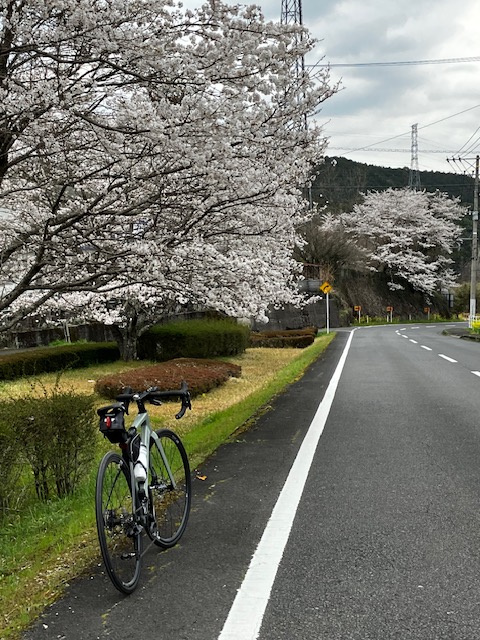
As I came down below 500m, I noticed some cherry blossoms and felt warmer air(pic.21). The hotel was near the end of down hill. I came down at 1000m height in 15km.
I booked Route-Inn Aso Kumamoto airport station hotel near airport. I received my cycling bag at the reception and discomposed my bike. The hotel also had a common big hot spring bath in their building. So after dipping myself in the bath, I went to dinner.
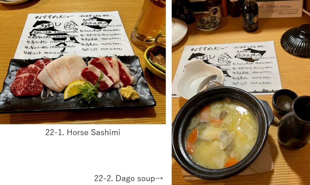
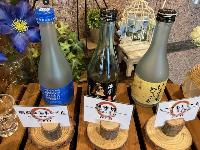
Since it was Sunday, only chain restaurant was open but the restaurant “Mekawa-suigun" served local cuisine such as horse sashimi, Dago soup which was similar with what I ate in my lunch. And Aso area’s Japanese sake, “Reizan"(pic22-2, left one) was also delicious though this area was famous for distilled “Shochu".
I booked a taxi in the morning next day and I departed the hotel at Am8:00 to airport. It took around 30min at around \2500-.
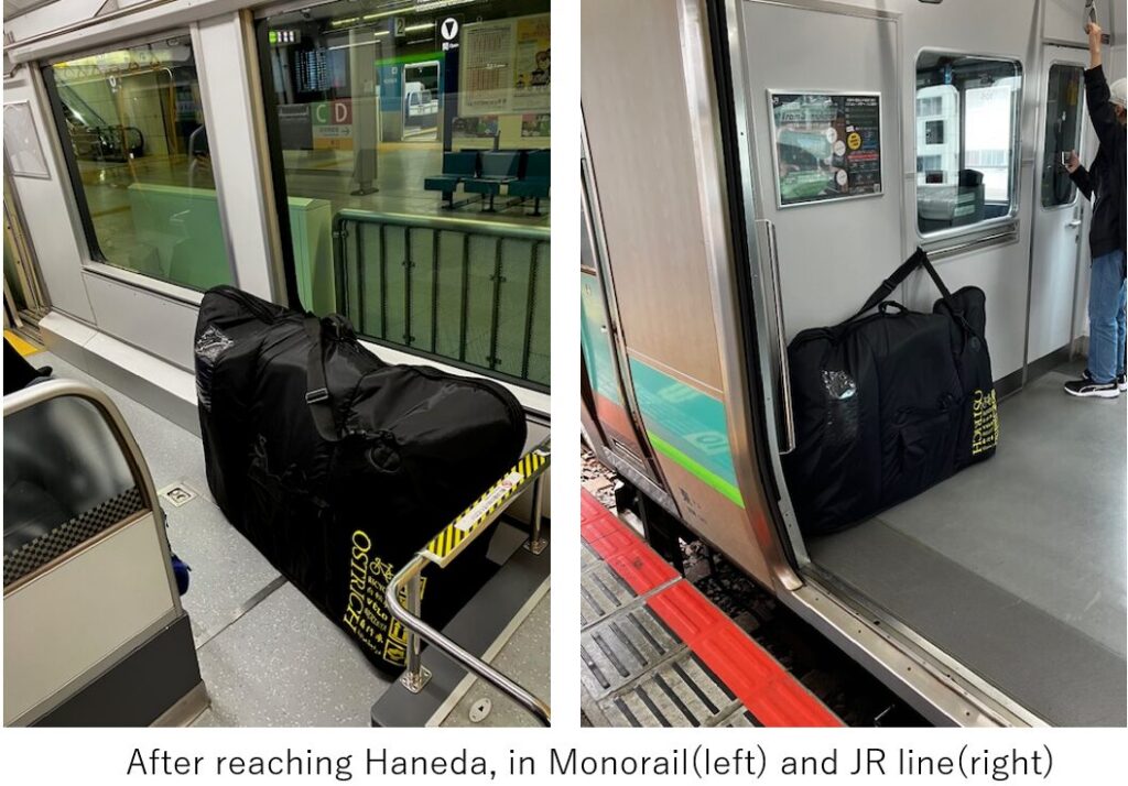
Since the cycling bag OS500 is bigger than a normal bag, the positioning in the train in Tokyo is important. In the monorail from Haneda airport to Hamamatsu-cho, there is limited space for the bike at the end of the car(left), and in my case I had to use JR local train, so I had to keep the end or front car(right). So the time to use those train should be in noon time to avoid rush hour.
<Transportation info>
Kumamoto airport to Haneda(tokyo): AM9:50 ANA2414(operated by SNA) →AM11:30
<Connected route>
I-1: Beppu hot spring to Yufuin
I-3: Mt.Aso to Takachiho