Bandai Azuma Skyline cycling(B-16)⭐⭐⭐⭐⭐ ‘25.7th,June
This route B-16 is in Area-B “Tohoku". See Area-B map/ See Japan map
Sight & Entertainment ⭐⭐⭐⭐⭐
Food & Drinks ⭐⭐⭐⭐
Easiness ⭐⭐⭐
Road consitions ⭐⭐⭐⭐
Safety ⭐⭐⭐
The wet season would start in the mid June, and in this year’s May, we didn’t have sunny weekends. So many Japanese people thought this weekend with fine weather forecast would be the only chance to go somwhere. So as to myself, and I chose Bandai-Azuma skyline.
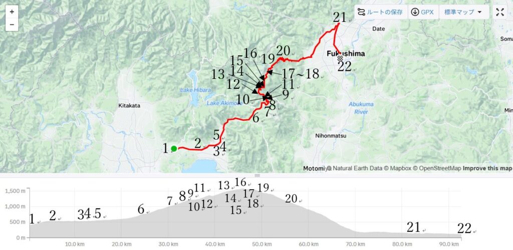
To save time as well as my stamina, I started from Banda station from which I started my cycling trip twice in the past (ref.B-1 Mt.Bandai hill climbing to Yonezawa, B-2 Aizu oouchijuku to Shirakawa) at AM9:40. Mt.Bandai could be seen very clearly(pic.1-2).
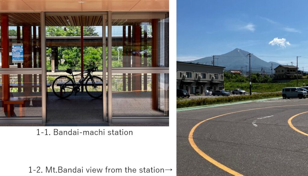
After a few km, there was a nice view point of Mt.Bandai which shape reflected on the paddy field field with water in this season(pic.2).
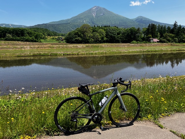
After 10km from the start, the road finally joined with R-115 which went toward hill(pic.3). Still from R-115, Mt.Bandai could be seen(pic.4).
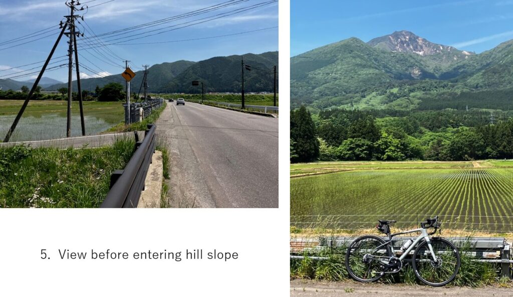
The landscape didn’t change so much until 20km point, paddy field and Mt.Bandai(pic.5). Then gradually the mountain road appeared.
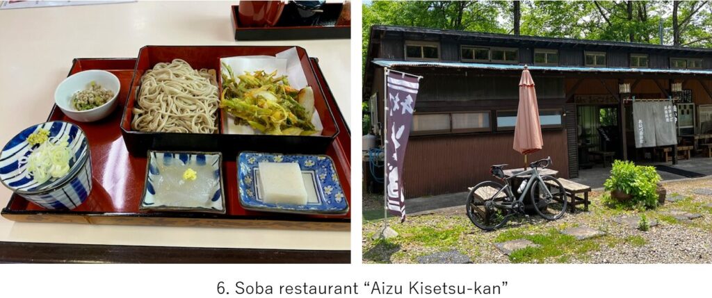
Though the time was still AM11:15, I knew there didn’t seem any restaurant in the mountain till reaching the hill top far away, I took a lunch at “Aizu Kisetsu-kan“, Soba restaurant. Aizu area seems to be famous for Soba culture, but espacially this area seems famous for serving 100% buckwheat soba, not including any wheat. I ordered Soba set menu with tempura of wild edible plants. I’m satisfied with a mountain taste.
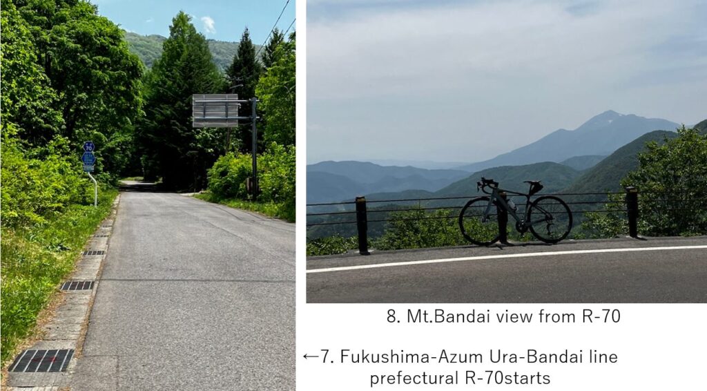
The 4~6% slope on R-115 continued for a while and finally I changed the road to prefectural R-70 which headed into hill top(pic.7). Gradually the slope became covered by forests shade and steeper. From some points, I could see a wide view of Mt.Bandai(pic.8).
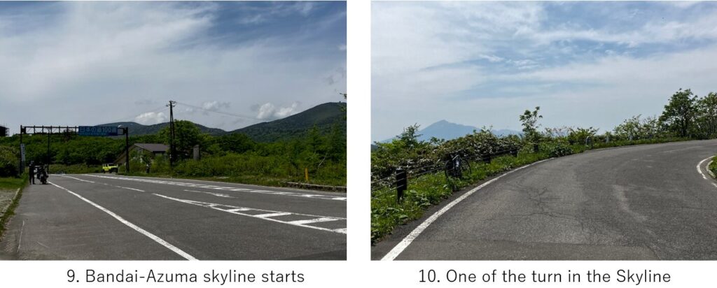
At the height of 1250M, Bandai-Azuma skyline which is chosen as a top 100 good roads in Japan started(pic.9). There were many turns and the slope became much steeper. But thanks to good views and nice temperature(around 20C), I didn’t feel fatigue.
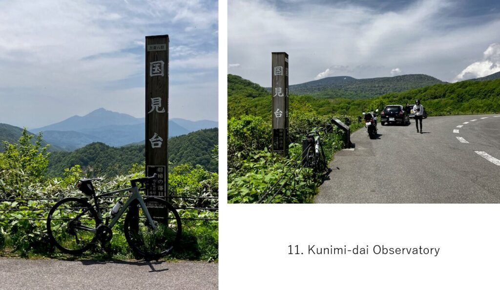
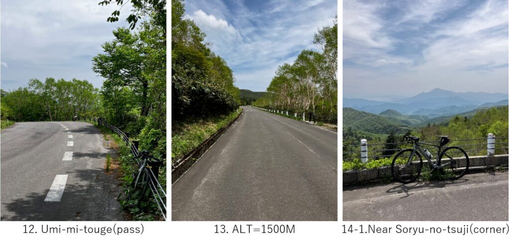
There were several good observatory like Kunimi-dai(pic.11), Umi-mi-gouge(pic.12). And when I came to 1500M altitude(pic.13),I noticed the vegetation changed by seeing white berches.
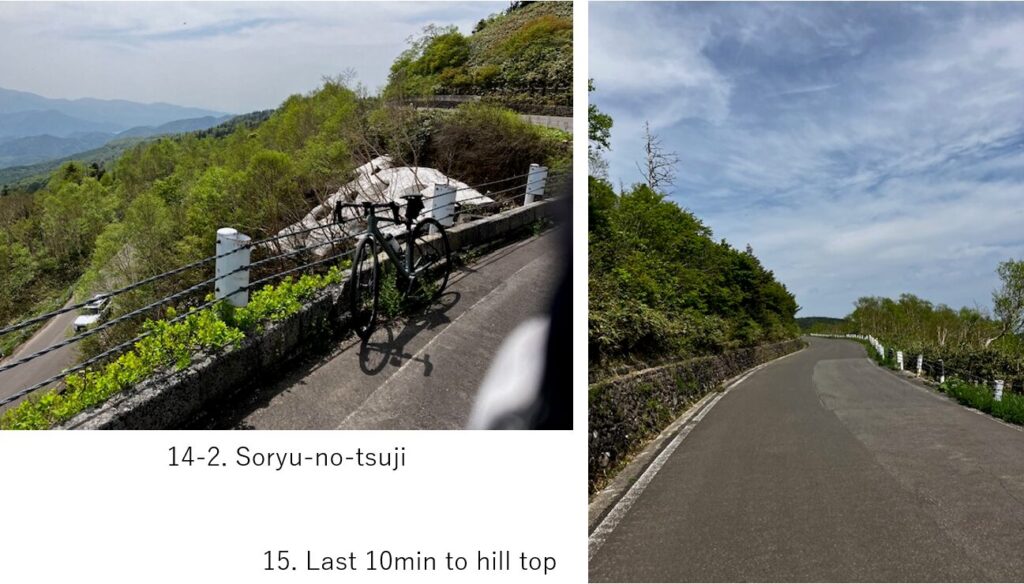
The Soryu-no-tsuji seemed the last hairpin curve to the hill top(pic.14). There were snow still remaining(pic.14-2).
Finally at PM1:50, I reached the hill top, 1622M height which was printed on the road(pic.16). From there down hill started. Soon a bare mountain spouting white smoke appeared in front(pic.17).
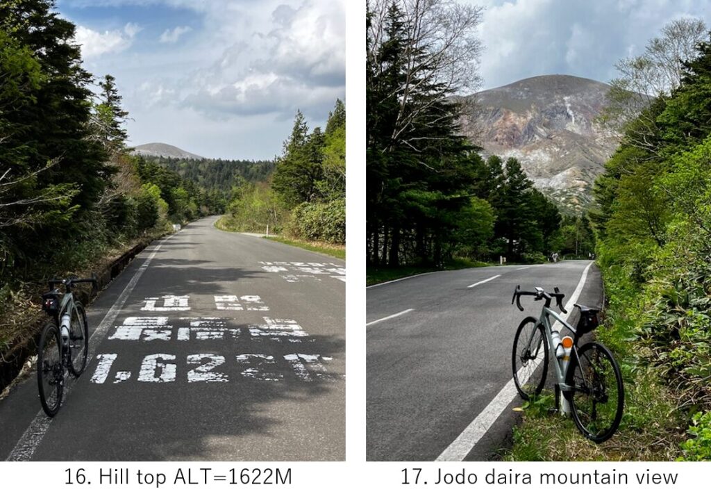
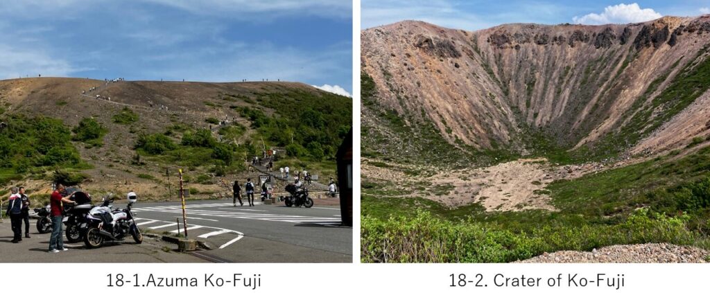
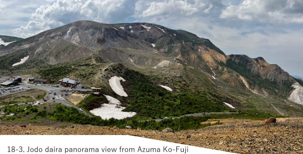
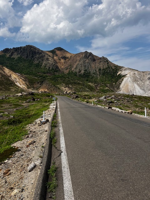
This place is a famous spcetacle, called as “Jodo daira" and there were many tourists(pic.18). By climbing around 50M, we can see a crater, called as “Azuma Ko-Fuji" (pic.18-2). From which you can enjoy a wide view of Jodo daira as well as a down hill road toward Fukushima city(pic.18-3).
The time was 14:30 when I started down hill from Jodo daira. Soon after starting, I noticed some boards writing “Close the car window" which cautioned tourists in the cars about toxic volcano gas. I also smelled sulfur gas there though of course I couldn’t stop breathing.
But the landscape there was very beautiful which I’ve never seen in other mountains(pic.19).
The steep donw hill in the volcano gas continued for a few km and after another 5km, the view of Fukushima city suddenly appeared on the right hand side(pic.20).
Still over 15km steep down hill continued. Sometimes I met some hill climbing cyclists coming up. I felt sorry for them since my direction was much easier than theirs. When I finished the down hill, the time was yet around 15:00, so I decided to go toward North to experience a famous hot spring, Iizaka Onsen(pic.21). The road to reach there was almost flat and a little narrow but not so busy.
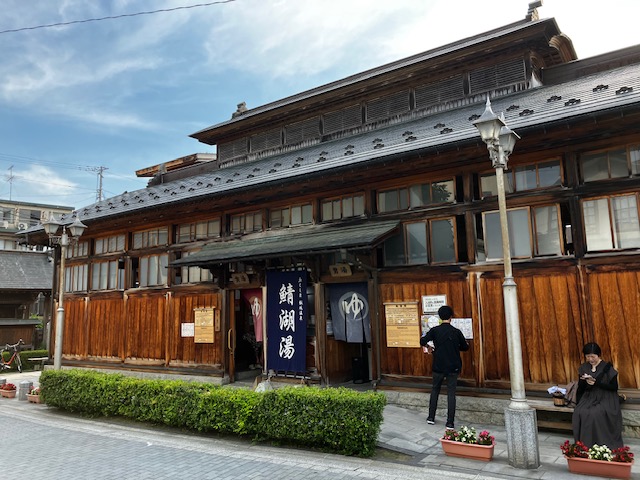
There were some public hot spring which you can enjoy at lower payment, \200-. In my case I bought a set of soap, shampuoo and towel at \600- additionally since there was no soap nor shampoo inside. And surprisingly there was no tap which we can see in usual hot spring facilities.
The hot spring is used by local residents for their daily bathing. So I carefully watched what they behave inside. The spring was relatively hot but I could fully enjoy a retro interior.
There was 10km from Iizaka hot spring to Fukushima, so again I had to sweat on my bike. As I come close to the center of Fukushima, the road became wider and busy. I reached my hotel near the station at 16:30.
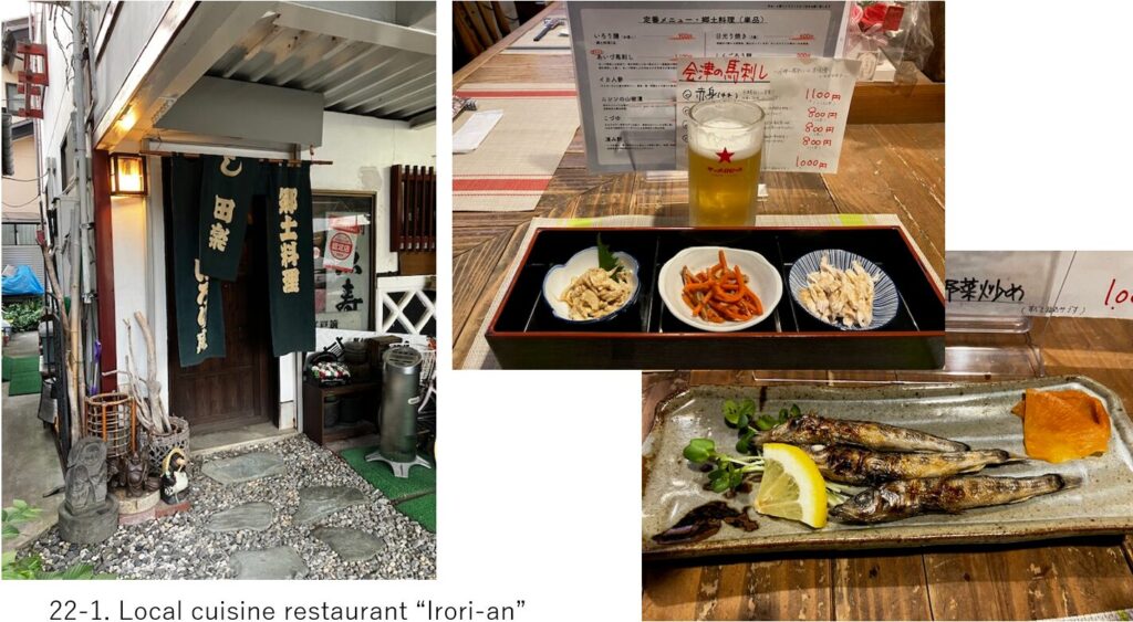
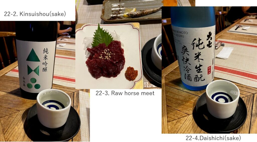
After taking a shower again, I went to a local cuisine restaurant “Irori-an, Dengaku" who serves mainly only Fukushima local cuisines. I again enjoyed a raw horse meet(pic.22-3), and some Fukushima’s Japanese sake(pic.22-2, -4). I again realized that I loved Tohoku area’s Japanese sake.
<Transportation info>
From Tokyo to Bandai-machi: Tokyo station AM6:20 YamabikoNo.201, arrival at Koriyama AM7:55, \7,810-, then AM8:29 JR Banetsu-Nishi-line, arrival at Bandaimachi at AM9:24. \990-
*Please note that there is no automatic gate nor officer at Bandaimachi, so you have to buy a ticket separately at Koriyama station.
<Other recommendable spots near my route>
Goshiki-numa(lake) (ref. My article(B-1): Mt.Bandai hill climbing to Yonezawa)
Aizu wakamatsu castle (ref. My article(B-2): Aizu, Oouchi-juku to Shirakawa)
<Connection routes>
B-1: Mt.Bandai hill climbing to Yonezawa