Kamikochi hill climbing(E-13)⭐⭐⭐⭐ ‘25.28th,June
This route E-13 is in Area-E, “Chubu-Hokuriku". See Area-E map/ See Japan map
Sight & Entertainment ⭐⭐⭐⭐⭐
Food & Drinks *No data in this time but Nagano has many delicious foods
Easiness ⭐⭐
Road consition ⭐(from pic5~pic8)
Safety ⭐(from pic5~pic8)
I’ve wanted to try reaching Kamikochi, the most famous and one of the most beautiful mountains spectacles in Japan someday. But when I saw the route to reach there, I became wary of planning it.But I thought it would be a chance to try in this weekend since the wet season surprisingly had already seemed finishing this year and the weather would be fine.
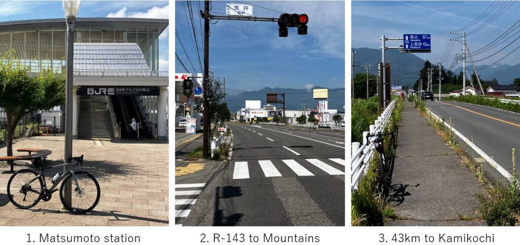
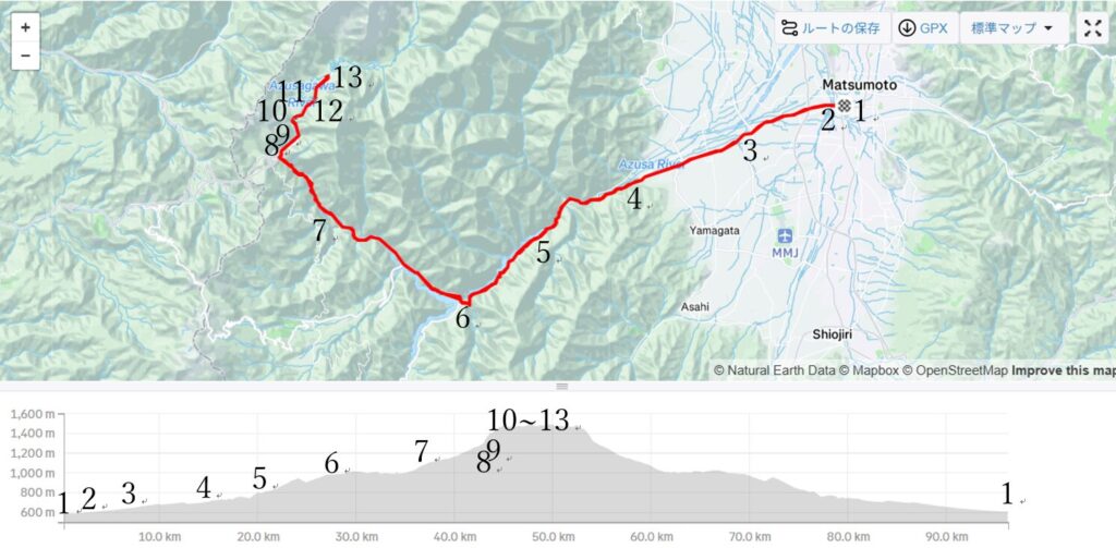
I got up at 4:00AM and caught a Hokuriku Shinkansen, Kagayaki No.501, AM6:16 departure from Tokyo station, then after changing train at Nagano station to Shinano No.4, reached Matsumoto station at AM8:37. The route to Kamikochi is simple, Just go West on the R-143(pic.2). Gradually the altitude increased and the road became narrower(pic.3).
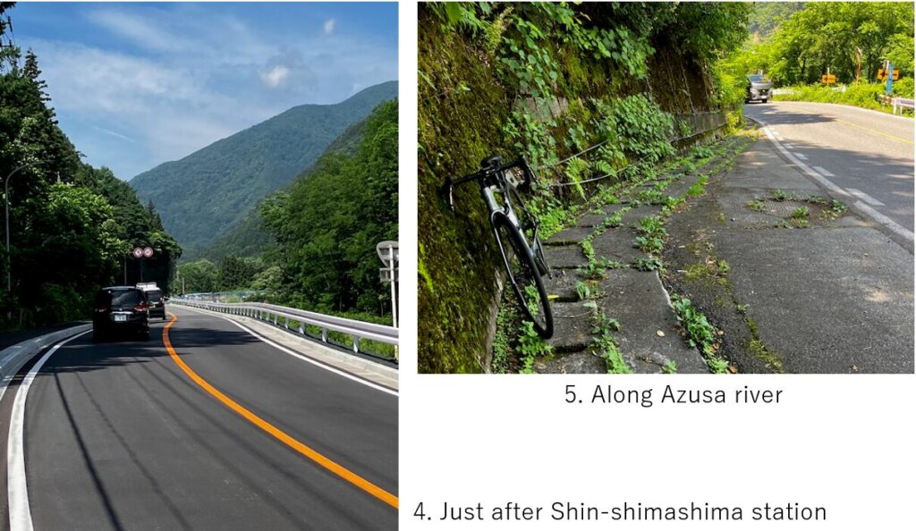
R-143 runs parallel with a local train as far as Shin-shimashima, the top of alluvial fan. But when the rail disappeared, the sight around R-143 became just mountains(pic.4). After a few km, the road started running along Azusa river and hill climbing started(pic.5).
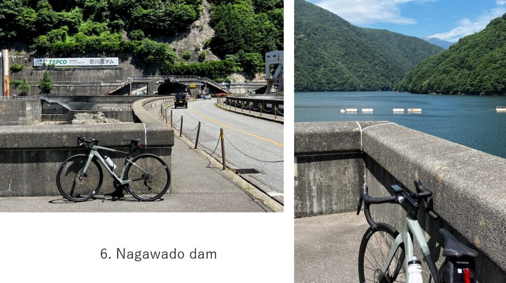
Yet the slope was not so steep but before coming to an big dam(pic.6), the long tunnels I was afraid of started. After this dam, again a long tunnel was waiting.
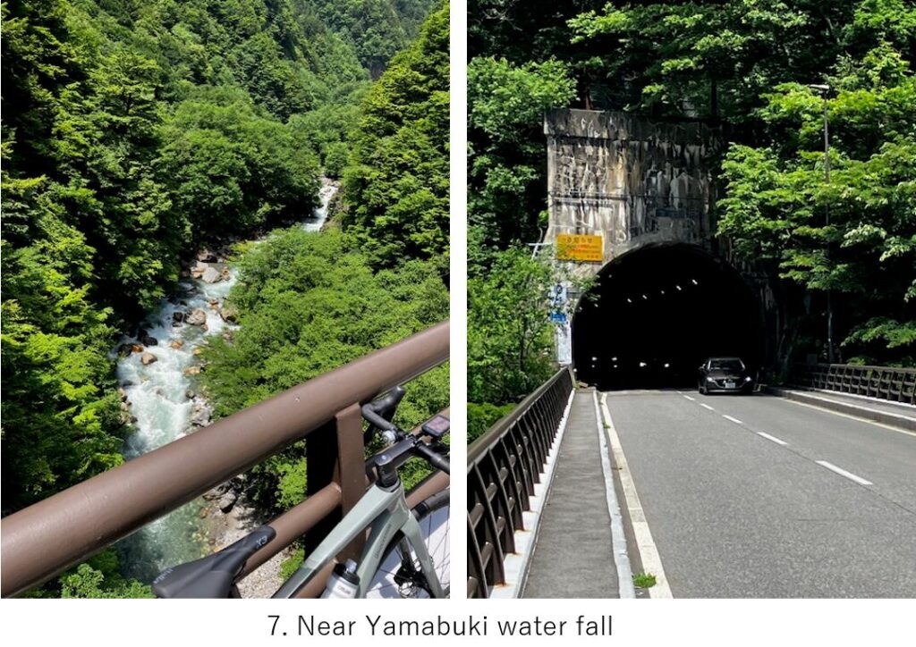
After the dam, there were many but most of them didn’t have pedestrian ways and were narrow. To make matters worse, many roads were under repairment and I could barely see some holes on the road in very dark sight. Uphills were still OK but I thought it would be dangerous in my downhill returning. One good thing is that the kamikochi visitors coming by my-car should park theirs just behind pic.7 and only buses and cars which went other places came up. So the road became not so busy. And the Azusa river sometimes I could see in the deep valley was very nice view(pic.7).
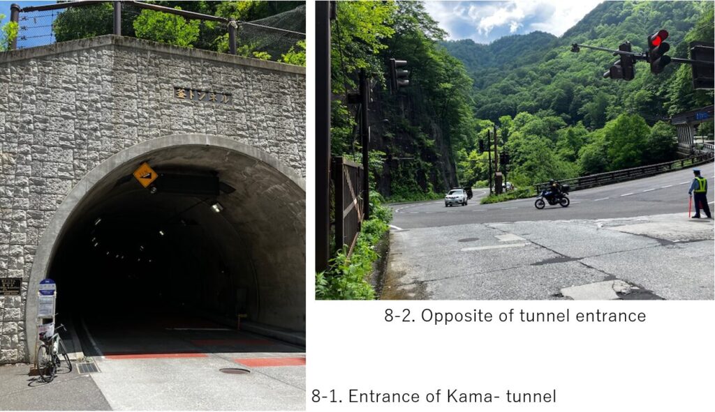
I saved my stamina well so far since I knew there would be a famous very steep tunnel(pic.8-1) at last. But gradually I felt tired as the slope became steeper. When I reached the entrance of Kama tunnel(pic.8-1,8-2), the accumulated altitude was over 700M.
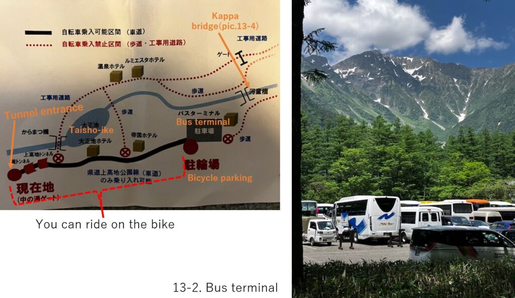
There were some guards standing in front of the tunnel to ban the normal cars coming(pic.8-2). They gave me a notice card shown with pic.13-2 and explained which place I could ride on my bike.
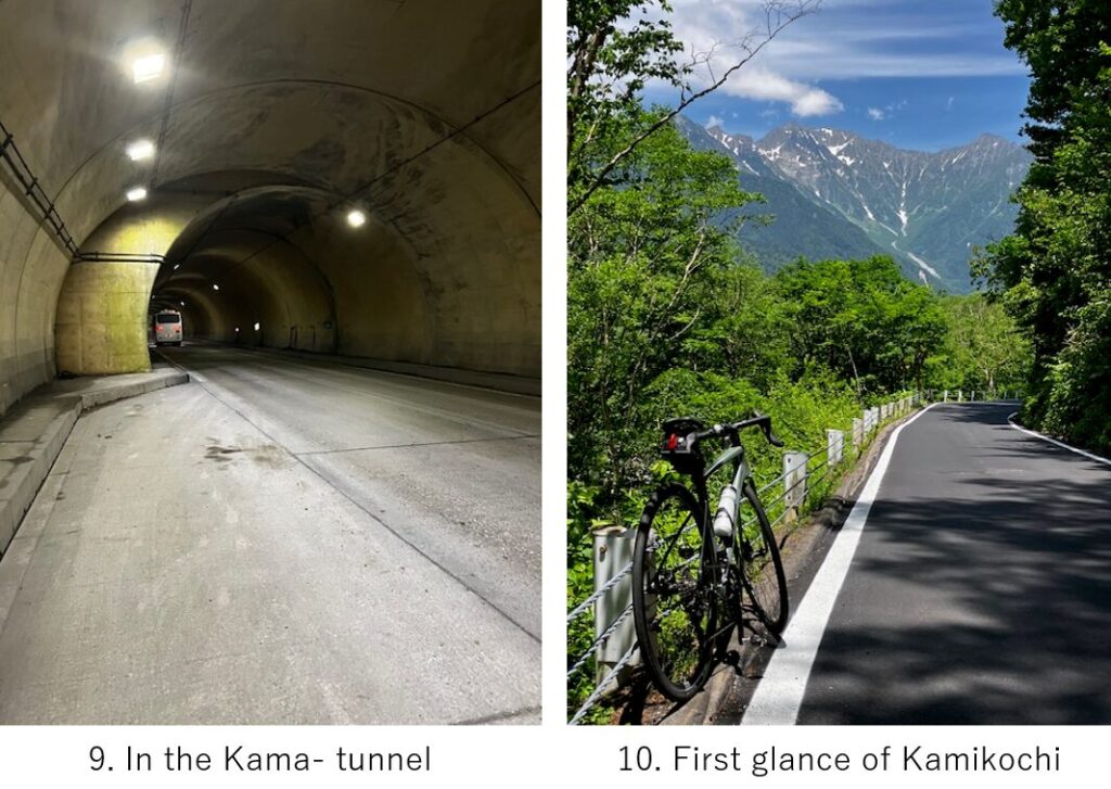
I took 10min rest before entering and finally decided to go. According to the guide, this new Kama-tunnel has over 1300m long and constantly 11 degree slope, and after that, there is still 500m long steep tunnel. I wanted to complete them w/o rest but after 400M, it became too tough and finally at 700m, I gave up and took a rest(pic.9). Some buses with many tourists eyes passed by..
I barely accomplished the tunnels with getting a leg cramp. But when suddenly the spectacle of Kamikochi appeared, I could not help but be moved(pic.10).
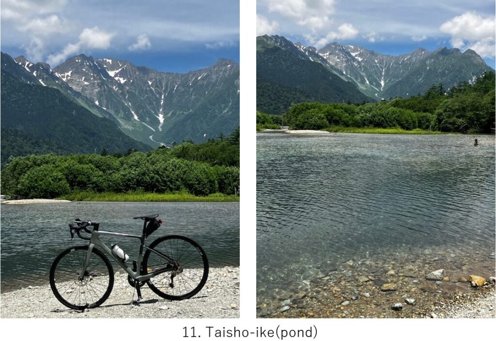
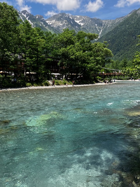
After a few hundred meters, I reached Taisho-ike spot. I had to carry my bike to the edge of the pond when again I got a cramp.. The water was very clear!!
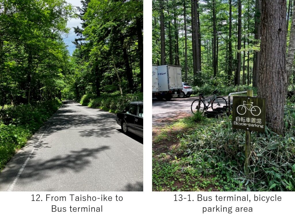
There were a few km from Taisho-ike to the terminal, mostly flat but a little up-hill(pic.12). When I reached the bus terminal(pic.13-2) where the cyclists also should park the bike basically, a guard told me that I could go inside toward Kappa bridge with my bike if I push it. So instead of parking it(pic.13-1), I brought my bike inside.
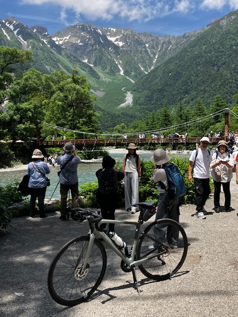
There was a promenade along the river and were many chances to take photos with Mt.Hotaka(pic.13-3), 3rd highest mountain in Japan with over 3000m height.

Finally I reached the highlight of Kamikochi, Kappa-bashi(bridge) (pic.13-4). Many tourists take pics on the bridge but I was hesitant since the bike would be an obstacle. Of course no other cyclists were there. According to some info, only 300 cyclists come to Kamikochi with their own bike from cities in one year.
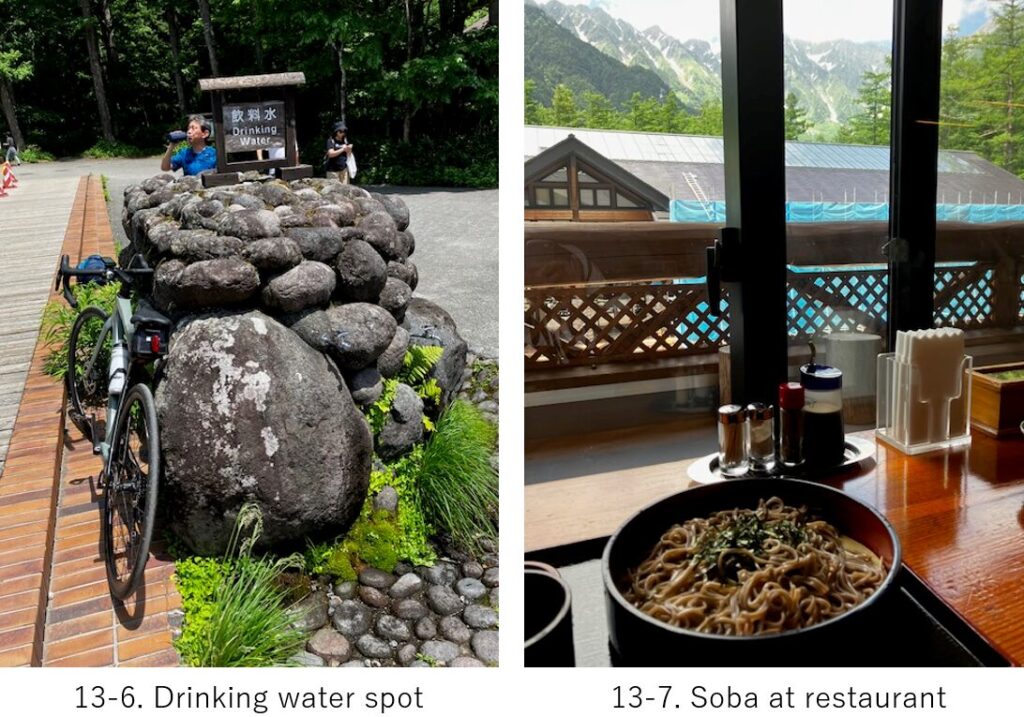
Coming back to the bus terminal. There was a tap for natural drinking water spot(pic.13-6). And I took a lunch at the 2nd floor restaurant(pic.13-7). While I was eating Soba, the top of the mountain was shrouded by clouds. The time was PM12:50.
Now the down-hill. The steep Kama tunnel was still safe since the road was new and well paved but those many tunnels on R-143 were scary. Besides my buttery of lamp has gone.. But with enough care, I could come back to Matsumoto station at PM3:00.
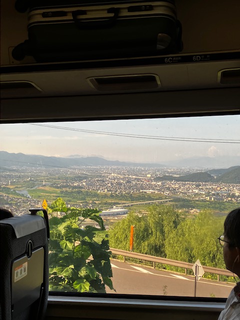
I caught an express Shinano No.15 PM4:05 departure to Nagano station. The train went through the mountains and came out to Chikuma river area. Then before arriving at Nagano, it came to Obasute area(pic.14), from which you could see one of the three best views from train. I came cycling last summer (ref. my article E-10, Chikuma river cycling) .
<Transportation info>
From Tokyo to Matsumoto: Tokyo station AM6:16 Kagayaki No.501 →Nagano station AM7:36, then AM7:44 Shinano NO.4 →Matsumoto AM8:37. \10,640-
From Matsumoto to Tokyo: Matsumoto PM4:05 Shinano No.15 →Nagano station PM4:56, then PM5:05 Kagayaki No.510 → Tokyo PM6:28 . \10,640-
<Other recommendable spots near my route>
Matsumoto castle(ref. E-8 Fossa magna cycling)
<Connection routes>
E-8: Fossa magna cycling
E-16: Kisoji to Suwa shrine