【Day2】Nagato to Shimonoseki(G-5)⭐⭐⭐⭐ ‘22.30th,Oct
This route G-5 is in Area-G “Chugoku". See Area-G map/ See Japan map
Sight & Entertainment ⭐⭐⭐⭐⭐
Foods & Drinks ⭐⭐⭐⭐
Easiness ⭐⭐
Road Condition ⭐⭐⭐
Safety ⭐⭐⭐
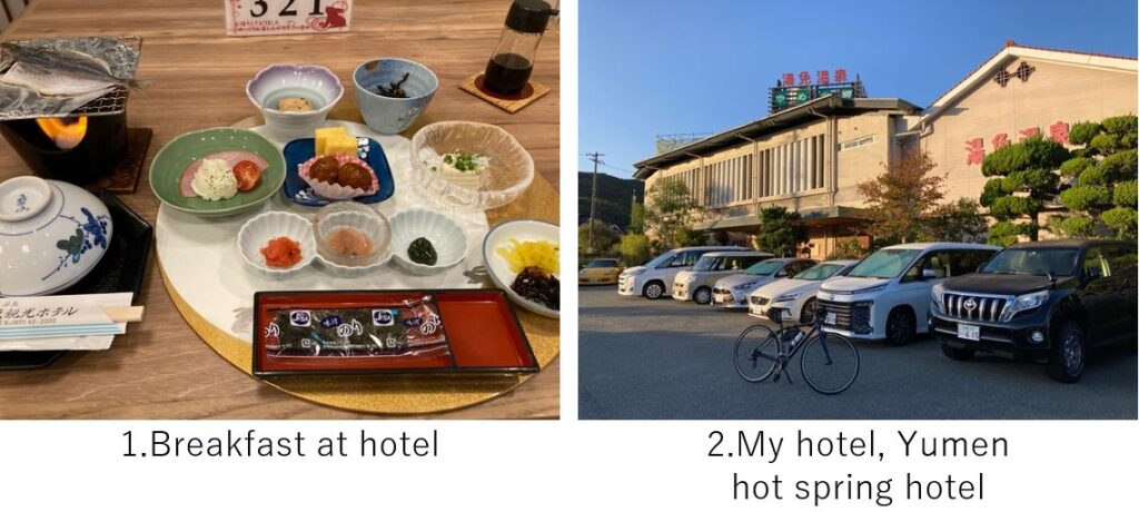
I woke up at AM6:00 and had a breakfast at hotel at AM7:00. I was typical breakfast in Japanese traditional hot spring hotels. The weather was fine, a little cold but comfy once I started cycling.
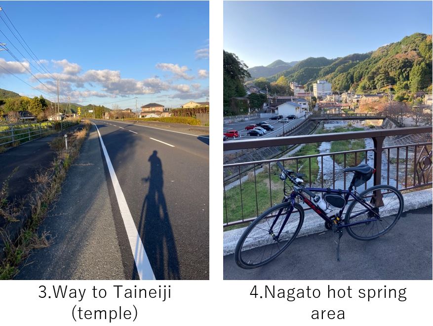
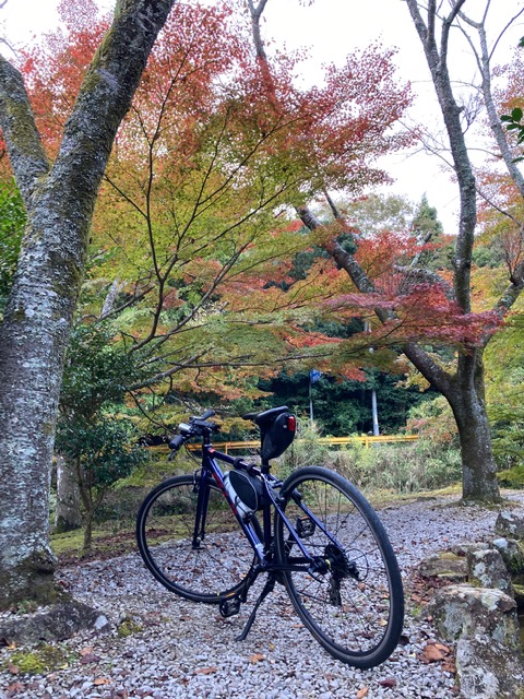
My first destination was Taineiji temple, which was famous for autumn leaves in the late autumn. I had to climb a hill a little(pic.3) but not so hard. The temple located near Nagato hot spring hotels’ area where I wanted to stay(pic.4). Unfortunately it was still early for the autumn leaves’ best time(pic.5). But there were many maple trees which must be very beautiful in middle of Nov.
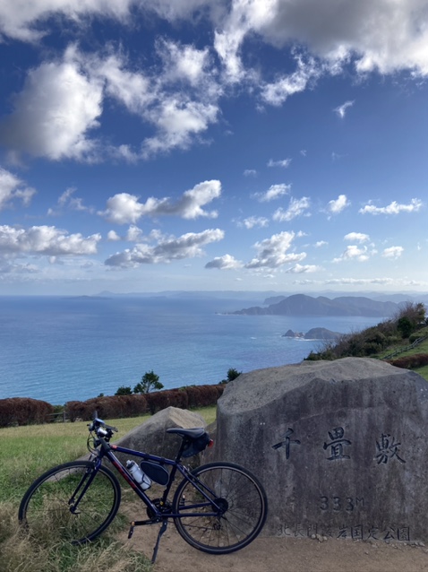
Now I headed toward shore side for Senjo-jiki and Motonosumi shrine. Since the slope toward Senjo-jiki seemed steep(333 height), originally I didn’t plan to visit there but it’s my bad(good?) habit to try the harshness once I come near that. So I started climbing the slope for Senjo-jiki. In the beginning it was not so steep and I could see the top very closely. But suddenly a very steep(maybe around 15 degree) straight slope appeared, which overwhelmed me. I wanted to overcome it w/o break but I couldn’t help stopping in the middle.
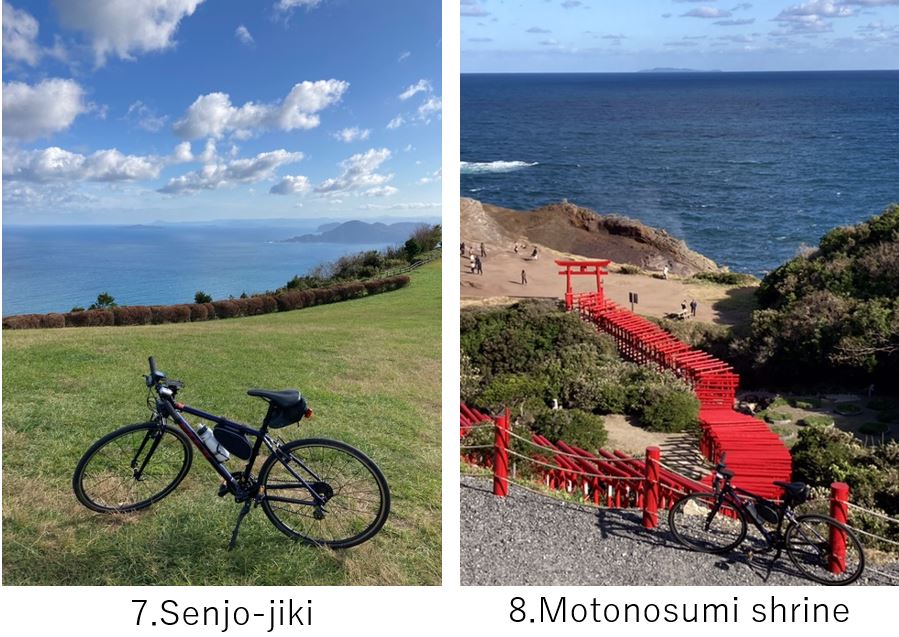
But the sight from the Senjo-jiki was very nice(pic.6,7). I was very satisfied with my decision to come here.
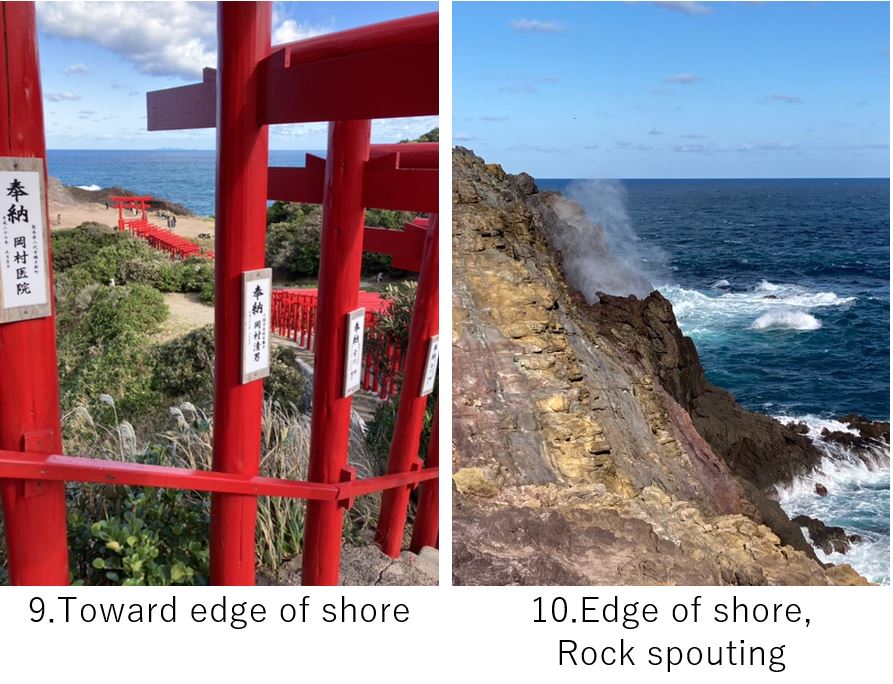
From Senjo-jiki to Motonosumi shrine(pic.8,9), it was mostly down-hill and very close. The shrine is famous for its many torii-gates. There were many tourists coming by cars, buses and motorbikes. I was the only guest coming by a bicycle.
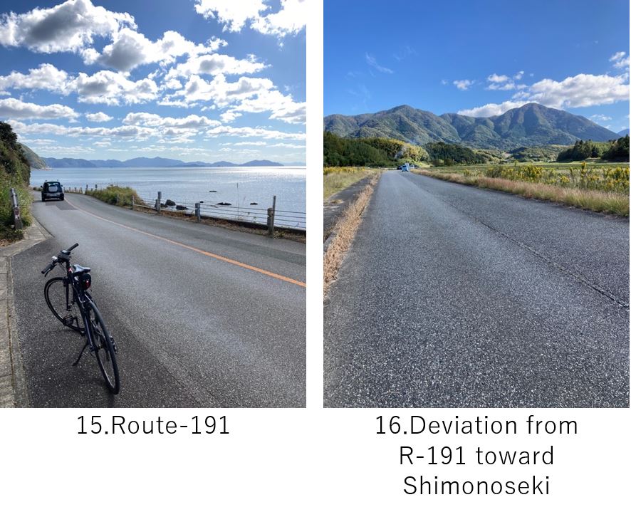
It was a quirky view even for me but spectacle since they stand on a steep cliff top over the sea(pic.10). Since the air was cool, I wanted to eat a hot meal but the shop was too small. So I again started cycling toward Tsunoshima ohashi bridge, a famous view spot for long bridge over blue sea(pic.13).
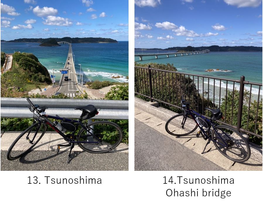
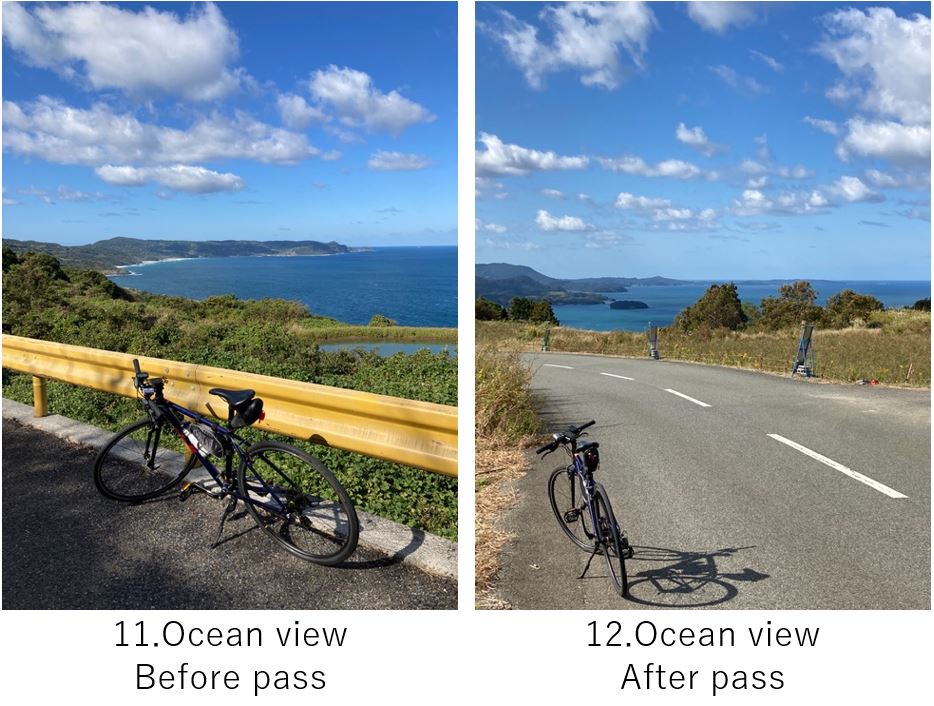
I thought there would be only down slope and flat road but unexpectedly I had to go some up-hills(pic.11,12) before entering Route-191 which runs to Shimonoseki, my final destination. The sight of the bridge and blue sea was very beautiful but pls note the bicycles can’t enter the bridge since it’s prohibited to stop in the middle of bridge for safety reason. Instead there were some restaurants which offer nice view of the bridge, so it would be nice to plan eating there. I wanted to eat late lunch at Karato-ichiba in Shimonoseki city, I abided by eating there, though it was a mistake for my stamina.
The Route 191 was the only main road toward Shimonoseki city, so many cars and trucks were running, by which sometimes made me threatened(pic.15). And to make it worse, many up and downs made me running out of stamina due to no charge after breakfast. After eating a little at a convenience store, I could continue cycling toward Shimonoseki city, still over 30km away.
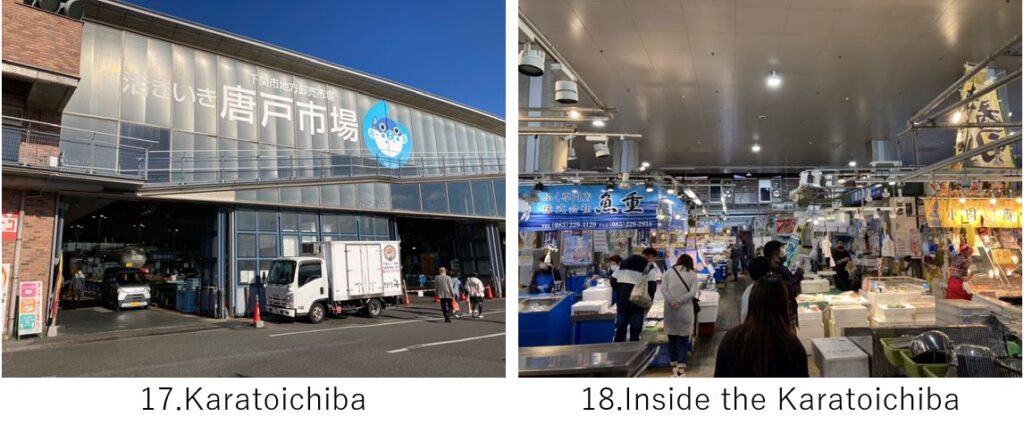
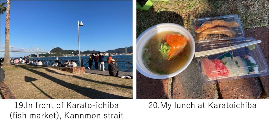
It was good choice to deviate the R-191 and took prefectural route-244. The road was not so busy as R-191(pic.16). When I came to Shimonoseki city, the road again became busy but somehow I could reach Karato-ichiba at PM3:00, where fresh fishes landed in the morning could be available. Unfortunately all restaurants inside were closed at PM2:30 and most small shops who sell Sushi, side dishes were going to close(pic.18), but I somehow got a crab miso-soup and Sushi, fried monkfish at \1200-(pic.20), and eat them at the space in front of the strait(pic.19).
It was over 120km cycling and I was very tired due to many up & downs as well as long steep hill climbing at Senjojiki, but I was very satisfied with this cycling by sense of accomplishment. I disassembled my bike at Shimonoseki station, 2km away of Karato-ichiba and went back to Tokuyama, where I had Bz meeting on Monday.
<Other recommendable spots near my route>
Omijima island, at Nagato city
<Connected routes>