Shimanami Sea Route(H-1⭐️⭐️⭐️⭐️⭐️) ‘22.4th.Jun
This route(H-1) is in Area-H “Shikoku". See Area-H map/ See Japan map
Sight & Entertainment ⭐⭐⭐⭐⭐
Food & Drinks ⭐⭐⭐⭐
Easiness ⭐⭐⭐ (Sec.A⭐️⭐⭐⭐️⭐/Sec.B ⭐⭐/Sec.C ⭐⭐⭐)
Road Condition ⭐⭐⭐⭐⭐
Safety ⭐⭐⭐⭐
【Section. A】
The rainy season starts in early June in most Japanese areas. But fortunately, our plan was blessed by God. We had to cross to Matsuyama city by ferry(pic.1) from Yamaguchi prefecture. The departure time was 7:00AM at Yanai-minato. It took 2.5hrs to Mitsuhama port(Matsuyama). We assembled our bicycles after leaving the ferry, then started at 10:00AM.
Going on normal roads, soon on the left-hand side, you can see a beautiful sea (pic.2) and it lasts over 10km. At 18km point from the port, there is a roadside station, “Fuwari"(pic.3). You can buy souvenirs and enjoy a famous local dish like “Taimeshi"- rice with minced sea bream(pic.5) as well as other seafoods there. But it was still early for us for lunch, we went on cycling to Imabari, the start point of Shimanami Sea Route.
We wanted to eat “Taimeshi" near our route, so we dropped in “Hama no Daidokoro– Shiosato", located in a small harbor(pic.4). It was a very tiny cafeteria, and I could buy the famous cuisine with kelp tempura at 1000Yen. Of course, it was very yummy. Now ready to enter into Shimanami route, the time was 1:00PM.
【Section. B】
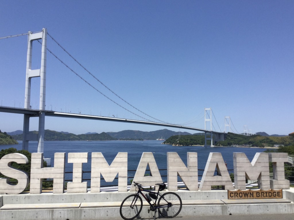
The starting point seems to be here(pic.6), there is Sun Rise Itoyama(Imabari city) Cycling Terminal which has a rental cycling shop. Now let’s go into the route along with the blue line guidance on the road.
Now coming to the top of the bridge(pic.7). Every bridge has a lane for cycling and pedestrians which is separated from the car lane. So it’s quite safe but pls be careful for motorbikes which also can run in the same lane with us. There are many small islands with old villages in which the ancient famous pirates lived–if you want to know the history of pirates, you can drop in “Murakami pirates museum" in Oshima(Section.B). When the bridge ends, you have to go down to a normal road. Then I was impressed by the well-designed accessways btw all bridges and the normal roads(pic.9). To ease the steepness of the slope, the accessways meander in the designed bushes which make shades and cool air.
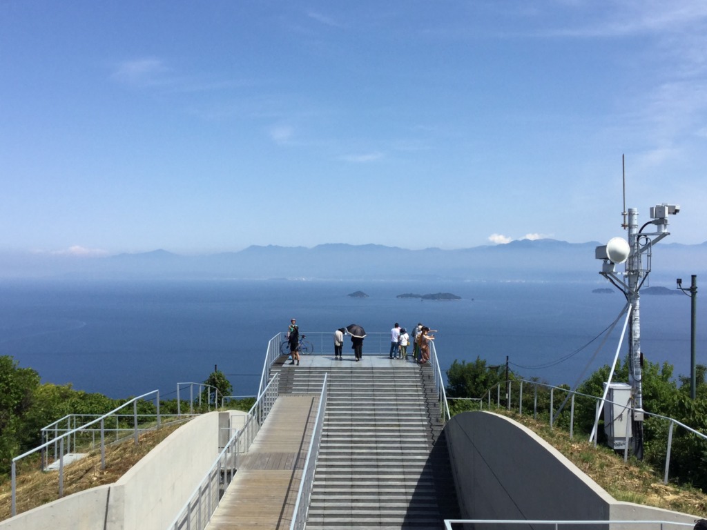
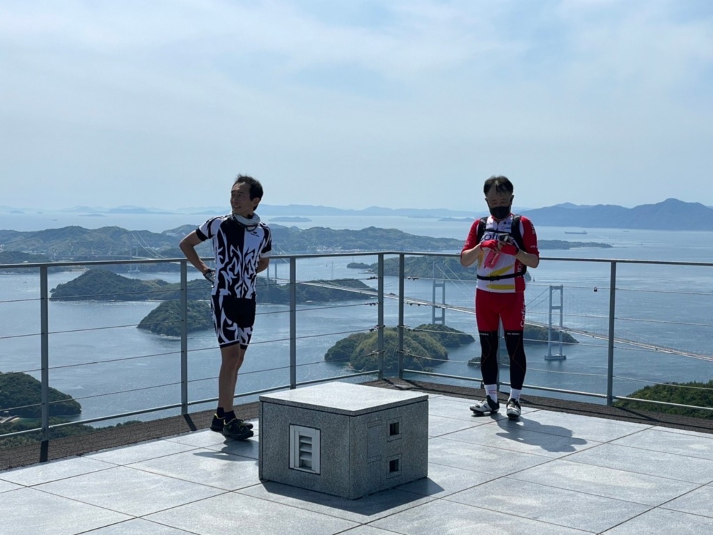
Now decision time, whether you challenge the hill climb to “Kirosan observatory" or pass the must-see view. Though we had already ridden over 50km, we chose the challenge. At the end of the accessway, we turned left and rode along with the route guidance. Turning right from R-317, the hill-climbing starts(pic.10). Total distance seems around 4km but the most are steep(over 10 degrees). It’s the almost final approach when you can find the wide-open view(pic.11). There was still 100m from that point to the real destination and we could enjoy a 360-degrees beautiful view from the top of the observatory(pic.13 & pic.14). And the salt ice cream(pic.12) sold at the shop was very yummy for my tired body. BTW, this salt, famous in Japan as “Hakata-no-Shio(salt)" originated in the next island.
There we’ve wasted too much time and now already 2:30PM and we still have over 60km to Onomichi, our goal. We went downhill and then again came back to the route 317 to cross the Ooshima island straight. In the next island, Hakata island,we chose the short cut to Onomichi and soon came to Oomishima bridge(pic.15).
【Section. C】
Since the strait under Oomishima bridge is very narrow, you can see the tide pattern on the sea surface. It looks like a large river(pic.16). After this bridge, you’ll reach a roadside station within 4km(pic.18). You will see many lemon trees in the end of Tatara bridge, on the next island. This region has relatively less rain in Japan and the climate is warm, like Mediterranean area, so it’s famous for the citrus fruits.
We took last long break before Ikuchi bridge then we were heading into 5th bridge but already tired with bridges. My body was really tired,so I didn’t have room to enjoy the sight in last 2 islands. On the final bridge from Innoshima island to Mukoujima island(pic.20), my speed was around 15-18km/hr. The time already passed 6:00PM before our goal(pic.21).
Finnaly coming into a town of Mukoujima island, the byciles are led to a ferry terminal to cross to Onomichi(pic.22). The ferries often go and come btw just a few hundreds meters strait. We paid 110yen on the ferry and finally reached our goal, Onomichi city.
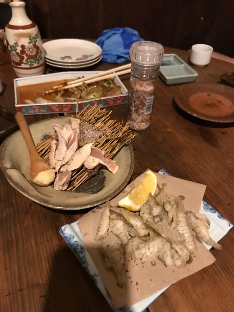
After taiking shouwer in our hotel room, we hung out the arcade to find a local cuisine then found a good one, ”Teppanya Kaibutsu"(1-9-1, Tsuchido, Onomichi city) (pic.23). It’s a typical local “Teppann yaki(grilled foods)" . You can enjoy them and raw fishes as well as local Sake. We stayed there till 11:00PM.
<Transportation info>
*Our route: Ferry from Yanai-Minato AM7:00 → Matsuyama AM9:30 ¥3,900-
*From Tokyo: Shinkansen btw Tokyo and Shin-Onomichi 4hrs ¥17,830- / Airplane btw Tokyo and Matsuyama 1.5hrs ¥40,000- (pls check with JR or JAL time tables)
<Other recommended spots near my route>
<Connection routes>
G-3: Kure to Onomichi