Fossa magna cycling(E-8) ⭐⭐⭐⭐ ‘24.29th,Apr
This route is in Area E, Chubu-Hokuriku. See Area-E map/ See Japan map
Sight & Entertainment ⭐⭐⭐⭐⭐
Foods & Drinks ⭐⭐⭐⭐
Easiness ⭐⭐⭐⭐
Road condition ⭐⭐⭐
Safety(Matsumoto~Hakuba vilage⭐⭐⭐/ Hakuba vilage~Itoigawa⭐)
I’ve believed this route is very nice to watch North Alps mountains. Now finally I had a limited chance to cycle there since snow on the top would disappear in May.
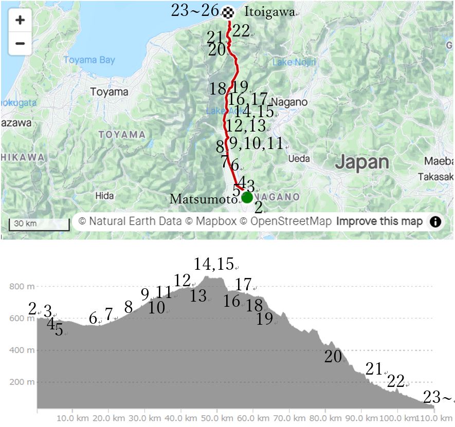
To start this route, I had to get on the first express, Azusa No.1 from Shinjuku station, Tokyo(pic.1). I worried about keeping bike space even though I had booked the back seat since it was in a long holiday season in Japan, but I chose the middle day of long holidays, which was right decision. The weather was relatively good but the forecast had told me that it would be cloudy in the noon time. Since Azusa No.1 reached Matsumoto station AM9:38, the time to noon was limited.
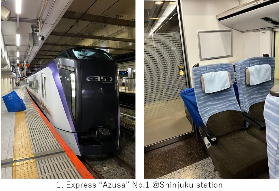
As the train reaching Matsumoto, the Alps mountains could be seen on the left hand side(pic.2). It might be the mountains of famous “Kamikouchi“.(To reach there by bicycle, you have to go from Takayama city, not from Matsumoto)
I assembled my bike ASAP and headed to Matsumoto castle in a few KM from the station. You can see the main castle tower(pic.3) without any payment. But it’s special castle which has been remained as it was built in the end of 16th century. It deserves to visit inside if you have time.
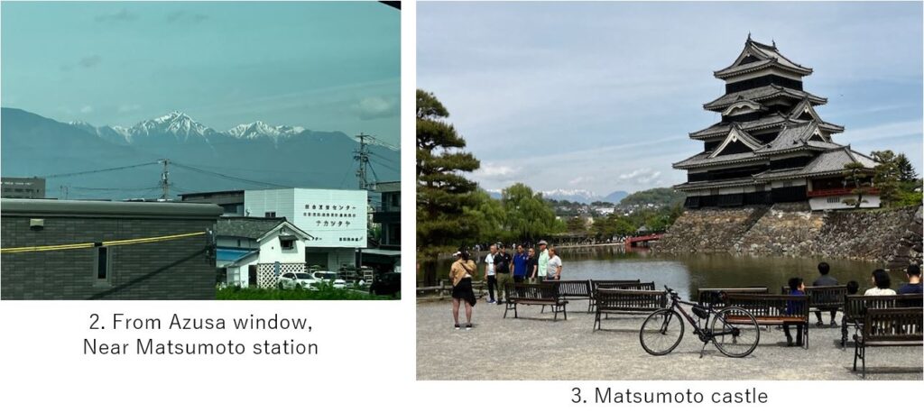
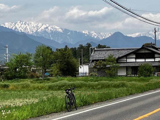
But I quickly left the castle since I wanted to reach near mountains before it would be cloudy. Some mountains can be seen from the city(pic.4) but there are many other peaks of mountains in this route.
The route was relatively simple, but it was not easy to find a good spot to take photos due to building s and cables(pic.5).
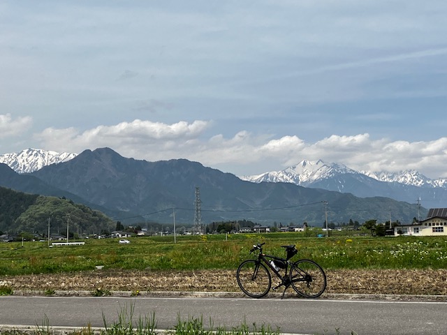
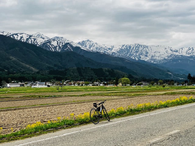
Gradually the mountains came closer. I think this route is the nearest route to the 3000M level mountains in my experience(pic.6). And this area, Azumino is very famous for very clear water as well as harvesting “Wasabi". Daio Wasabi farm is the biggest farm of Wasabi in Japan. I wanted to visit there but due to the weather, I skipped in this time.
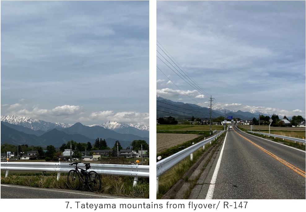
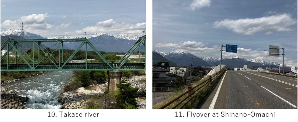
When I came to the flyover, it was a good chance to take photos(pic.7). From this area, Tateyama mountains were visible(right side in pic). The road was not so well paved and unexpectedly it was slightly uphill due to climbing alluvial fan, but the traffic was not so busy and there were very few signals, the cycling itself was comfy.
Now reaching the end of the alluvial fan, those mountains which were visible from Matsumoto city came to the closest position.
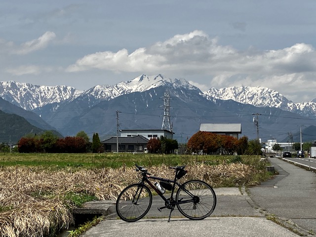
The spectacle was overwhelming. Now I might feel the same way with doctor Naumann when he saw this spectacle and named “fossa magna". This alluvial fan is located btw 2 rows of high mountain range and 3000M mountains are towering suddenly very close to the flat area.
Now the route is coming to the narrower space. It was already passed AM11:30.The weather luckily held out before I was satisfied with taking photos.
Now I had to search a lunch place. But the road came into the mountains, besides the slope became steeper..(pic.13).
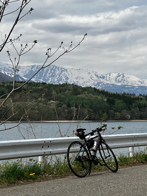
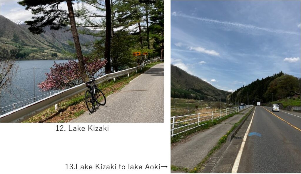
The lake Aoki is the highest place in this route. The sky became cloudy now.
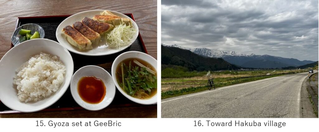
Finally at the end of lake Aoki, I found a stylish Ramen shop “GeeBric" which seemed only one restaurant in this area. The taste was good.
After lunch, the down hill seemed to start. I deviated from the R-148 and took a local road(pic.16) to have a better look of mountains. It lasted for 5km until I came back to R-148 heading to gorge.
Now in the Hakuba village. This village is very famous for skiing. According to the map, the peak of Mt.Hakuba is just 10km in a straight line from here.
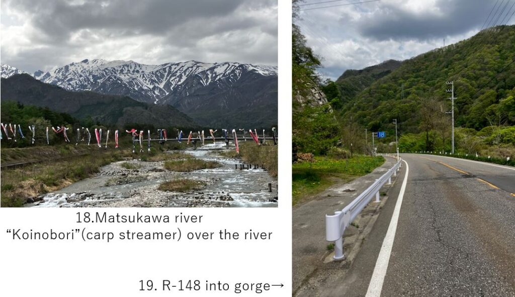
After crossing Matsukawa river which is merged to Himekawa river at this point, the road finally came into the gorge(pic.19). Soon a long, dark tunnels started. In this time, I didn’t check how many dangerous tunnels existed beforehand, so I was a little bit taken aback.
Though the route before coming here was very nice, the route suddenly became dangerous. Most of tunnels didn’t have pedestrian way nor enough space for bicycle, besides it was dark and road surface was very rough. So I recommend you to terminate cycling at Hakuba village.
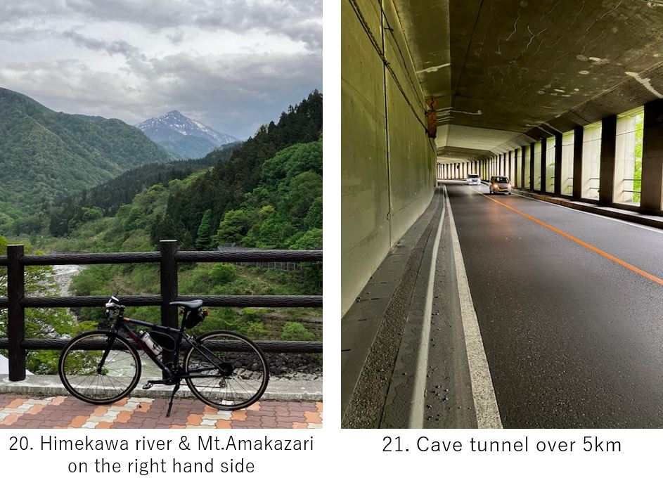
More surprisingly, after such dark tunnels, now very long cave tunnel started(pic.21). It was blighter than the last tunnels but still not happy for cyclists.
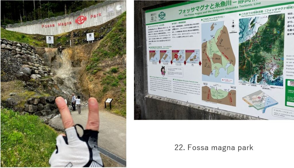
Still I was looking forward to visiting Fossa magna park ahead(pic.22). It’s located almost in Itoigawa city. As you can see, the Japan main island is divided into 2 pieces at this point. The west part belongs to Eurasia and the east to North American plate. This place is coveted by people who love geography.

Thanks to long down hill, I could reach the hotel in front of Itoigawa station at 16:10. After taking shower, I went out to find my dinner place. Surprisingly some restaurants were fully booked in such small town. The master at Shigezushi told me that many inland people (from Nagano prefecture) often visited here to eat fresh fishes.
As usual, I enjoyed local fresh fishes and Itoigawa’s local Japanese sake. And by chance, a Chinese tourist sit near me, so I enjoyed talking with him for a while. He seems to love Japanese nature and planned to visit Alps alone. I hope much more such real local Japan lovers visit local Japan. This is also my purpose of writing this blog.
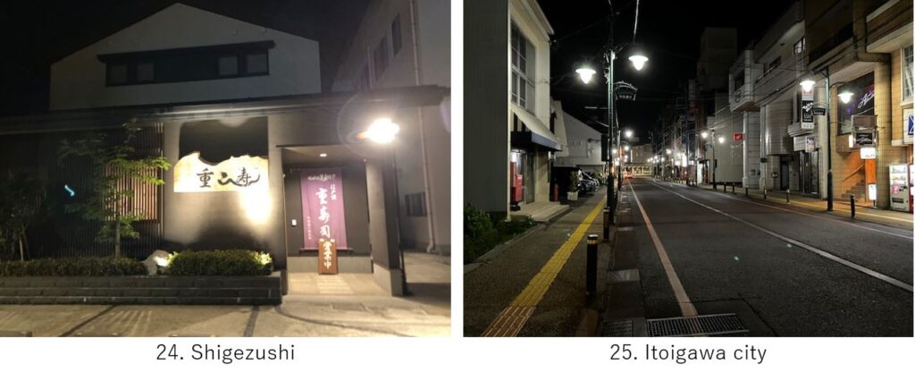
As usual in local city, when I came out of dinner, very few people was walking. Despite the warm air in daytime, I felt cold at night.
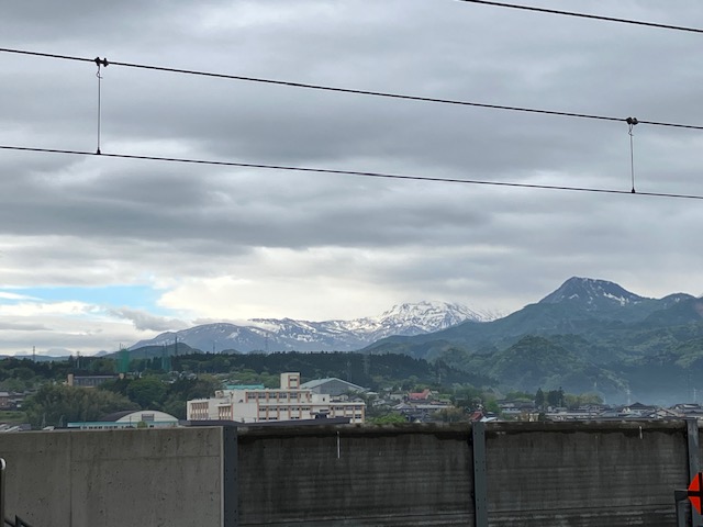
Next morning I caught AM8:10 Shinkansen from Itoigawa station. From this station, still high Alps mountains can be seen (pic.26). I love this area!
<Transportation info>
From Tokyo to Matsumoto: Shinjuku station AM7:00 Azusa No.1 → Matsumoto station AM9:38 \6,620-
From Itoigawa to Tokyo: Itoigawa AM8:10 Hakutaka No.554 → Ueno AM10:16 \11,190-
<Other spots near my route>
Fossa magna Museum: In Itoigawa city
<Connected route>
E-3: Toyama, Tateyama mountains range
E-5: Itoigawa to Naoetsu, Kubikli cycling road
E-13: Kamikochi hill climbing
E-16: Kisoji to Suwa shrine