Oh-i river hill climbing(D-14)⭐⭐⭐⭐ ‘23.3rd,May
This route D-14 is in Area-D “Tokai". See Area-D map/ See Japan map
Sights & Entertainments ⭐⭐⭐⭐⭐ *Up to your plan
Foods & Drinks ⭐⭐ *Up to your plan.
Easiness ⭐⭐⭐
Road condition ⭐⭐⭐
Safety ⭐⭐⭐
3rd Golden Week has come since I bought my bike. I always go back my parents’ home in this week with my bike since then. This time I planned to go to deep in the mountains along Oh-i river for a hill climbing training. Oh-i river flows from the high mountains, South Alps range and its flow is very fast so it divides East JPN and West JPN cultures from the past.
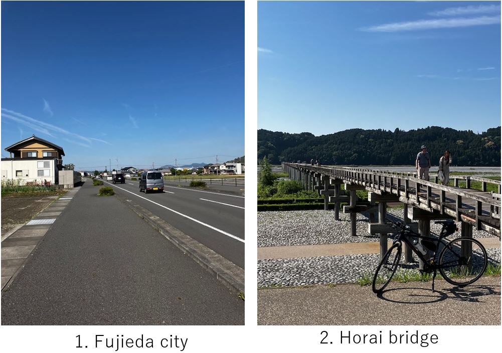
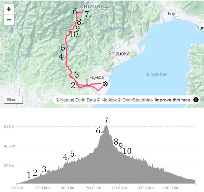
Starting at AM8:00 from Yaizu city, then 10km ride in the Fujieda city(pic.1) brought me to the Oh-i river bank. Soon I reached my first destination, Horai bridge(pic.2), certified by Guinness record as “the longest wooden pedestrian bridge in the world".
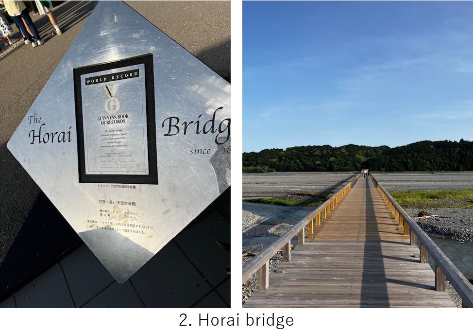
It was built in 1870 to cultivate the Makinohara plateau which is now famous for Japanese tea production by a lord Tokugawa, who was ousted Edo(Tokyo) when revolution occurred. Before that in Edo era, people had to cross this rapid stream by walking or by professional carrier. Sometimes in rainy season, they had to wait for over weeks until the flow calmed.
This is still used as an agricultural road as well as tourism. \100- to walk on the bridge.

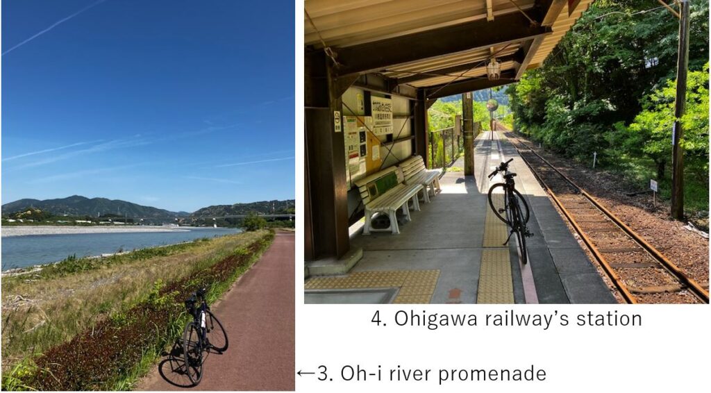
Then I took a promenade(pic.3) along the river for 5km. It was sunny and was a comfortable cycling with seeing the river flow. After that, the typical mountain road started toward deep in the mountain. Sometimes up and down was there along the river and the SL railway(Oh-igawa Railway) along the river, though the SL didn’t run recently due to a landslide last year. That’s why I could take a pic(pic.4) on a platform. If SL was running, there should have been many people along the way but I could have taken a pic with SL.
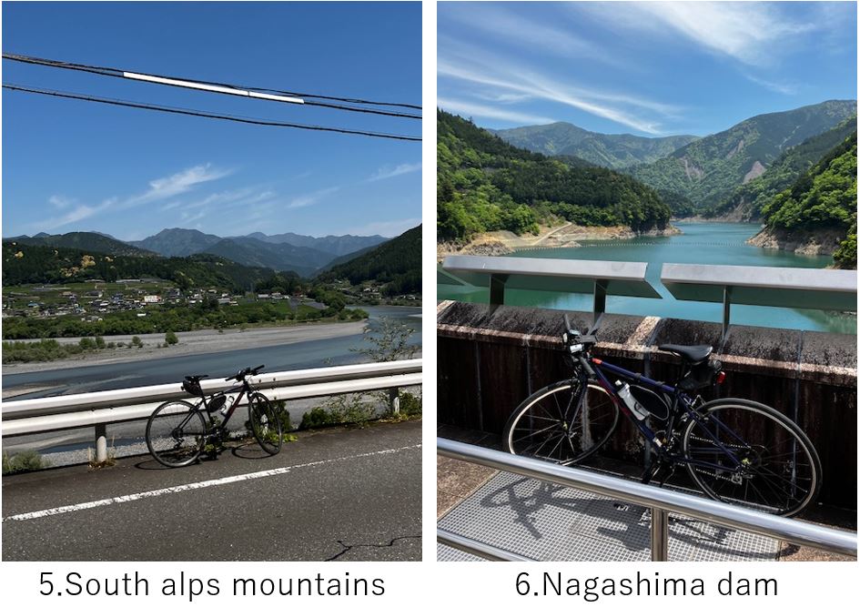
Again I went deeper in the mountain(pic.5) and I reached Senju station, the terminal of SL as well as the starting point of Abt system train(Ikawa line) at AM11:00. There were some restaurants and shops there but I continued cycling toward my final destination, Oku Oh-i kojo station.
Suddenly the road became steeper but not so harder than I imagined. Within 10km I reached Nagashima dam(pic.6). From there I could reach the view spot of Oku Oh-i kojo station in a few KM. I had not expected to encounter a train coming to the station with my timing but luckily the train came there in a few minutes. So I could take a nice pics(pic.7) with other visitors.

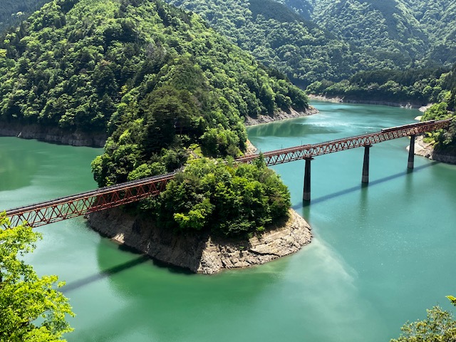
The station is on the edge of the peninsula(not an island), which means the river meanders here.
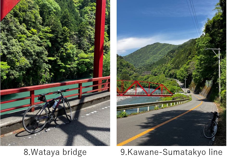
Now I was very satisfied with the chance and took a way back home. There were some nice landscape on my way(pic.8,9) before reaching Senju station. And the downhill was very comfy.
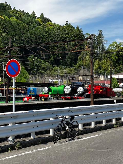
But once I passed Senju station(pic.10), strong south wind killed the speed and up and downs appeared repeatedly. So I felt a little tiered in my returning way unexpectedly. Finally I reached Shimada city, in an alluvial fan of Oh-i river, then the road became calm down slope toward East, so I could cycle with comfortable speed.
<Transportation info>
*From Tokyo to the nearest station of Oh-i river, Shimada station: Shinkansen Hikari(or Kodama) to Shizuoka station 1hr(or 1.5hr), then JR Tokaido to the West 30min. Total \6270-
<Other recommendable spots near my route>
Hot springs in Kawane Honcho, like Sumatakyo and Sessokyo
<Connected route>