Toyama, Tateyama mountain range(E-3)⭐⭐⭐⭐⭐ ‘23.3rd~4th,June
This route E-3 is in Area-E “Chubu-Hokuriku". See Area-E map/ See Japan map
【Day1】Shin-Takaoka station to Himi city
【Day2】Himi city to Itoigawa city
Sight & Entertainment ⭐⭐⭐⭐⭐
Food & Drink ⭐⭐⭐⭐⭐
Easiness ⭐⭐⭐⭐
Road Condition ⭐⭐⭐⭐
Safety ⭐⭐⭐⭐ *R-8 after point 22 is dangerous ⭐⭐
Toyama prefecture is my most favorite prefecture among 47 prefectures in JPN other than my birth prefecture, Shizuoka. The spectacular view of 3000M height mountains can be seen from the coast of Toyama bay. The rich fresh fishes are landed thanks to the height mountains near the coast, which means there is a deep bay which nurtures rich fishes. The mountains supply with clean water which makes agricultural crops tasty. People are diligent and calm thanks to such atmosphere.
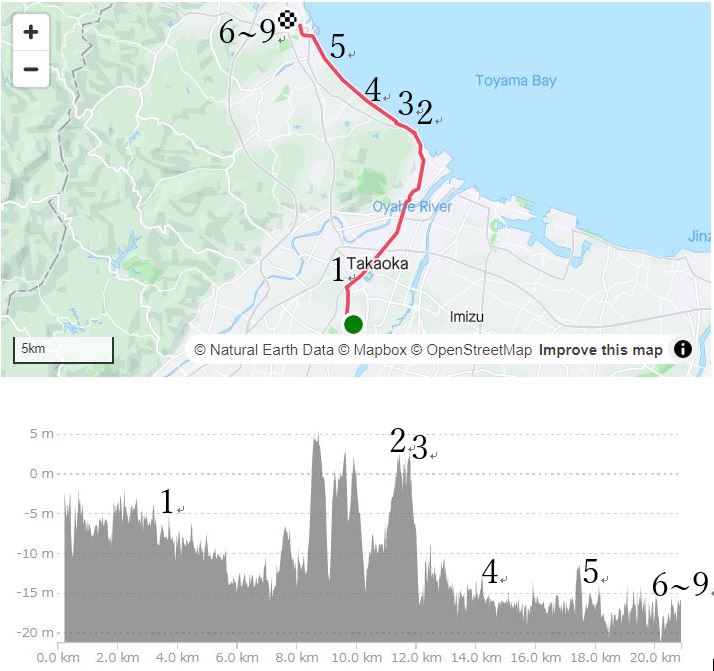
【Day1】Takaoka city to Himi city
I wanted to come here in May since the chance of clear vision of mountains with snow might be high and it was the season of firefly squid and white shrimp which are special in Toyama bay. But I didn’t have a chance in May. And June, the rainy season has come. I was about to give up the chance but fortunately the chance suddenly came. The weather forecast on Thursday said it would be fine from afternoon of Saturday in the weekend. So I booked the ticket of Shinkansen and a hotel at Himi city.
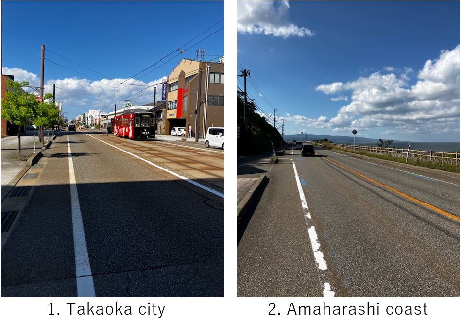
I reached at Shin-Takaoka station in Toyama at PM3:10 and started 20km cycling toward North. The road was very wide. Sometimes trams passed by(pic.1). After 10km, I reached the coast(pic.2).
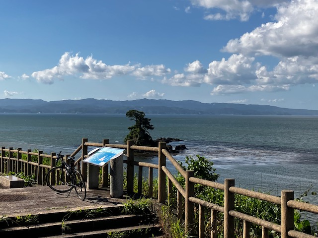
Soon I came to Amaharashi observatory which I wanted to take a pic(pic.3). This spot is famous for the view of 3000M height Tateyama mountains range with bay as well as Noto peninsula(pic.3). It was sunny but due to clouds on the Tateyama side(south direction), I could not take a good pic for South. I hoped I would be able to take a good one.
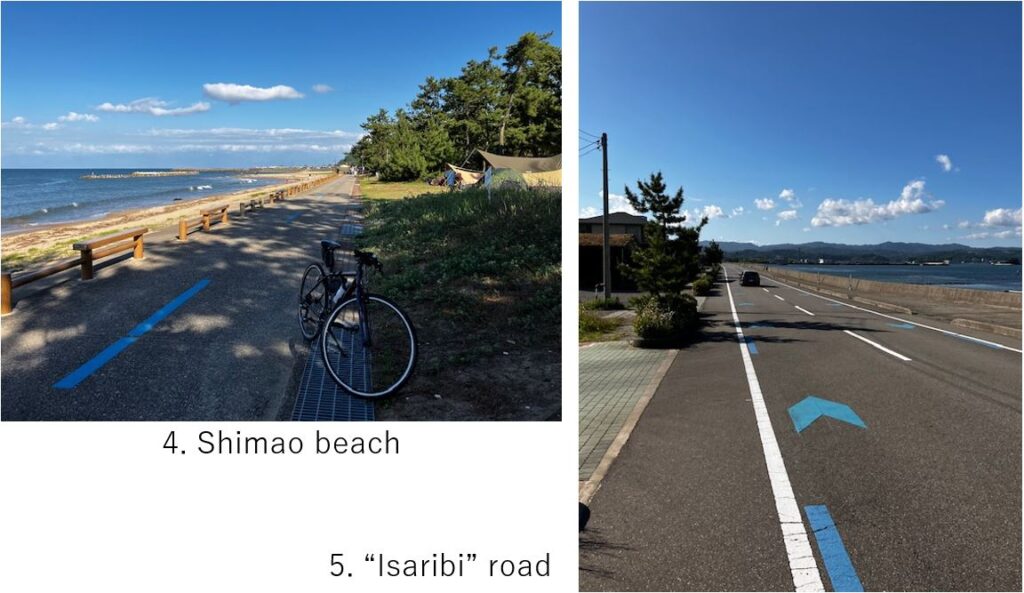
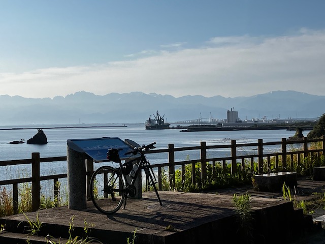
There was a guide(blue line) for cycling along the coast(pic.5), so it was very comfortable to ride. And there were some camping spots from which high mountains can be seen(pic.4).
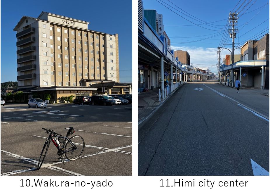
After one hour cycling, I reached my hotel, Wakura-no-yado(pic.10) in Himi city. The hotel serves a ocher colored hot spring with a reasonable price but a little far from down town. So I walked 1km to reach a traditional Japanese restaurant, Shigehama which I had checked beforehand.

The restaurant opens at PM5:00, so I entered just on time and ordered Sashimi which landed Himi fishing port soon. Of course it was very delicious. The restaurant was very cozy since it was run by a family and not so big. Except me, there were one regular family customer, so I could enjoy food as well as talking with them.
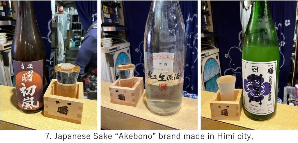
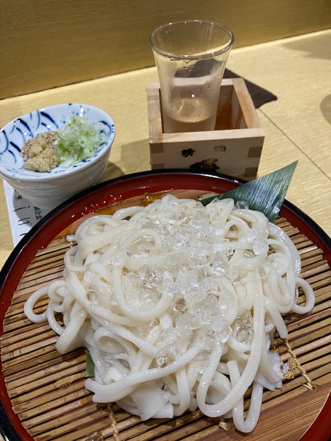
Toyama is also famous for its delicious Japanese Sake made of good rice and water thanks to high mountains and cool weather. I ordered Himi’s local sake(pic.7) whose brewery name was “Akebono". And finally I ordered “Himi-Udon" which is the specialty food in Himi city and one of three major Udon in Japan(pic.8). Surrounded by local Sake and local fish and Udon, I was very happy.
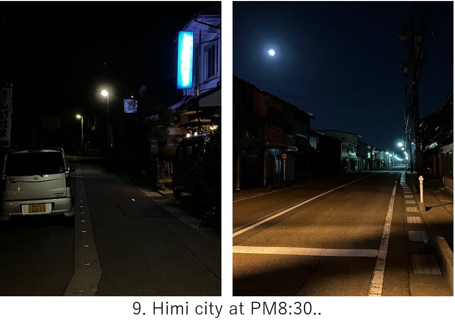
When I came out of the restaurant, the town had already fell asleep as I always see in my local cycling trip(pic.9). I want to encourage the local towns of Japan when I retire my current job.
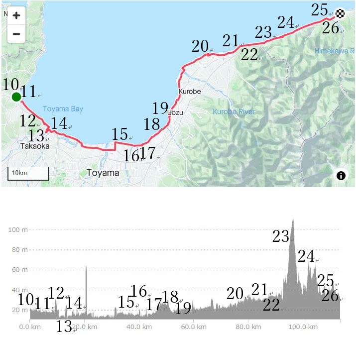
【Day2】Himi to Itoigawa station
The master of restaurant recommended to go 10km North in early morning to take a best shot of bay and mountains w/o any artificial objects but I could not wake up so early. When I woke up at AM5:00, the sun had already rose. And to catch my PM1:48 Shinkansen at Itoigawa, I had to go South soon.
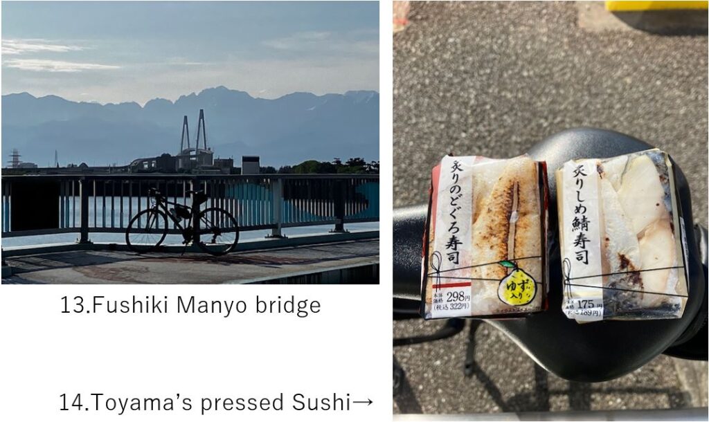
Starting at AM6:00, I reached the observatory at AM6:30 where I could take a high mountains pic(pic.12). It would be nicer if you come here in Spring season with good camera.
From this spot, I could see the mountains all the way(pic.13). And it was always comfortable cycling since the traffic was always low. What I was only annoyed by was finding a convenience store for my breakfast since it was in a countryside. Finally I found one and found a local special rice ball, pressed Sushi which can’t be found in Tokyo area(pic.14).
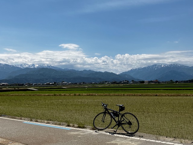
Basically there was a cycling guide(blue line) on the coast side road, so I need not to search a course with google map and enjoy the mountain view(pic.15). Now the scene of mountains became with the farm area but gradually came closer.
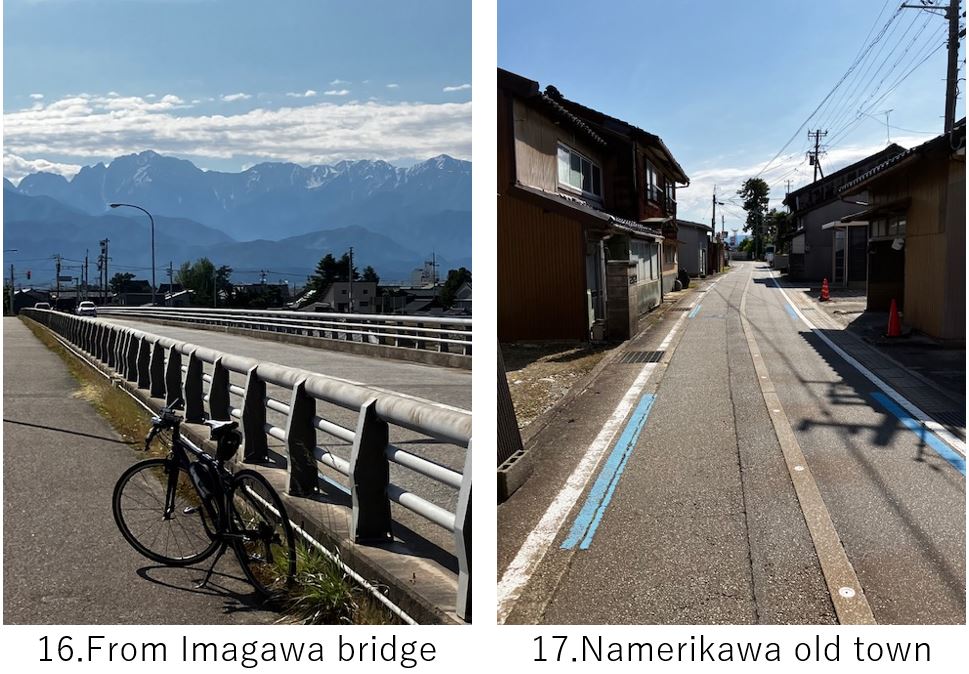
The blue guide line always can be seen even in the old town road(pic.17).

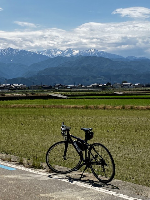
Maybe this area is the nearest from the Tateyama mountain range(pic.18).
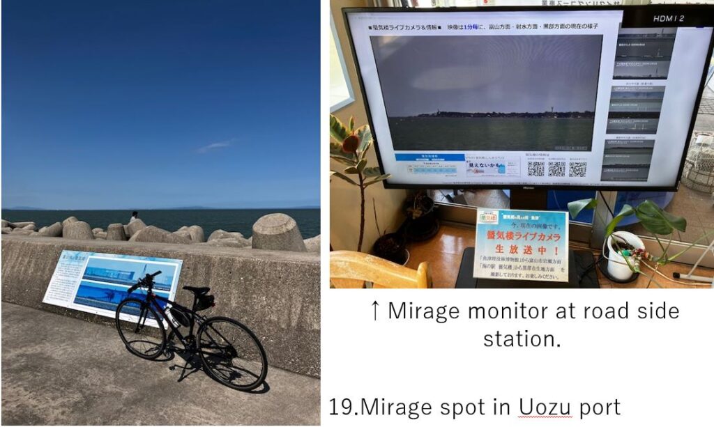
After 70km cycling, I reached Uozu port which was famous as the mirage view spot in JPN. Actually this timing was also the season of mirage but its appearance condition was very complicated, so I gave up watching that happening though there were some people waiting for the chance since it was fine day. I recommend you to stay at least over a week here to see that phenomena.
Gradually the mountains went to far West(pic.20) and finally disappeared after 90km from the starting point. Then the sight completely changed(pic.21). The road runs in a narrow space btw the outer see(Japanese sea) and the cliffs.
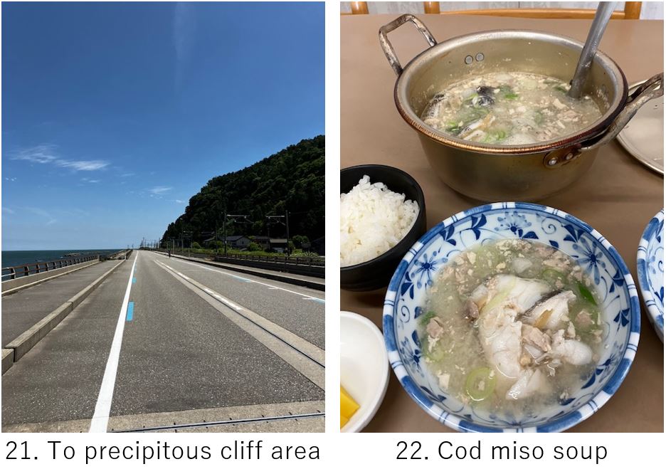
The time was around AM11:00 and I got hungry, but there seemed few restaurants along the way. But I could find a good local restaurant “Sakae Shokudo" who served special cod miso soup(pic.22). It seemed simple dish but very delicious thanks to soup stock made of cod’s liver. It would be nicer in cooler season.
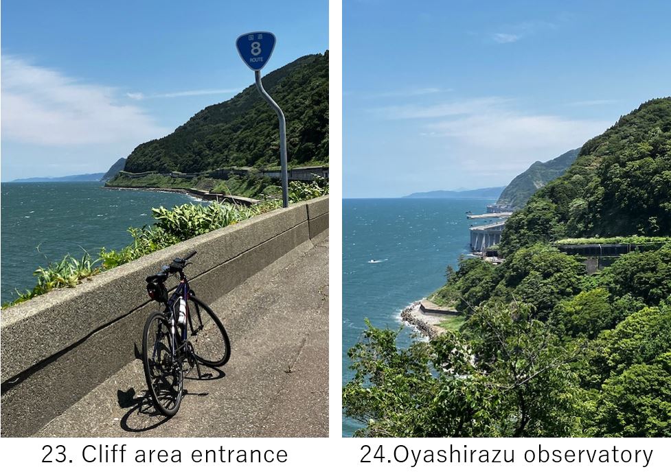
Now final section toward Itoigawa station. But there was a dangerous route waiting for me, though the spectacle was marvelous(pic.23). For geography geek, Itoigawa is very famous and exciting place since the line from Fuji river to Itoigawa divides the East and West Japan geographically. The area from this line to 20km-100km east zone is called Fossa Magna. Along this line, Japanese horizontal tectonic line bent vertically, which created the Tateyama mountains range.
It’s one of the reason why steep cliffs faces the outer sea coast directly and it shows a spectacular view as well as makes a dangerous route(pic.24). It started with a hill climbing and then the route began meandering down hill on a narrow cliff with many tunnels. Besides the route was a main road which had many big trucks. So I recommend to finish cycling before coming this cliff.
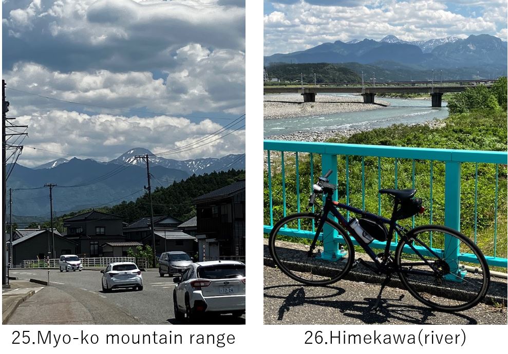
After15km dangerous cycling, I came to the plain. There I could see a different mountain range which lies in the Fossa Magna zone(pic.25). Finally I crossed the Himekawa(river) which divides East and West Japan(pic.26) and reached Itoigawa station at PM12:30.
<Transportation info>
From Tokyo to Shin-Takaoka(my case): Shinkansen “Hakutaka" 563 Tokyo 12:24 – Shin-Takaoka 15:03 \13,300-
From Itoigawa to Tokyo(my case): Shinkansen “Hakutaka" 564 Itoigawa 13:48 – Tokyo 15:52 \10,670-
<Other recommendable spots near my route>
Anyway pls refer to Toyama prefecture website
<Connection route>
E-4: Kanazawa to Takaoka
E-5: Itoigawa to Naoetsu, Kubiki cycling road
E-8: Fossa magna cycling