【Day2】Ise to Nachi “Kumano kodo” sacred shrines(D-5)⭐⭐⭐⭐ ‘22.17th, Mar
This route(D-5) is in Area-D “Tokai". See Area-D map / See Japan map
Sight & Entertainment ⭐⭐⭐⭐
Foods & Drinks ⭐⭐
Easiness Up to Kumano City(No.7 point) ⭐/ Later ⭐⭐⭐⭐
Road Condition ⭐⭐⭐
Safety ⭐⭐⭐
Starting at 8:00AM, soon the steep up and down began, which made my heart breaking off because I had to ride over 120km this day again and the uphill would wait for me in the final section. Taking the route along the coast seemed tough since up and down happens near each village, but it was correct decision. Route 42 which runs straight in the mountain requires much tough uphill and enduring heavy traffic according to people living here.
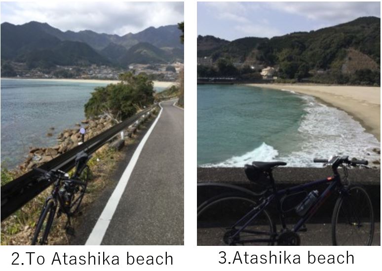
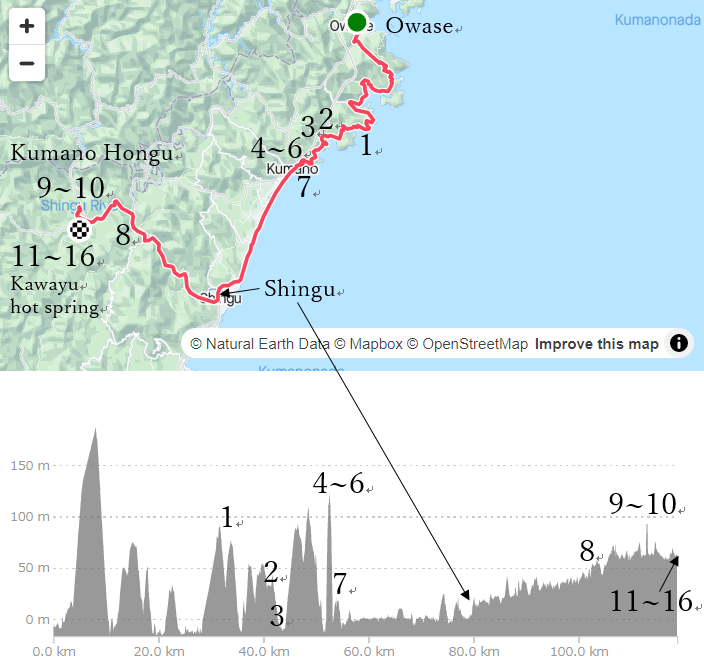
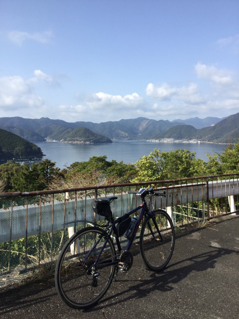
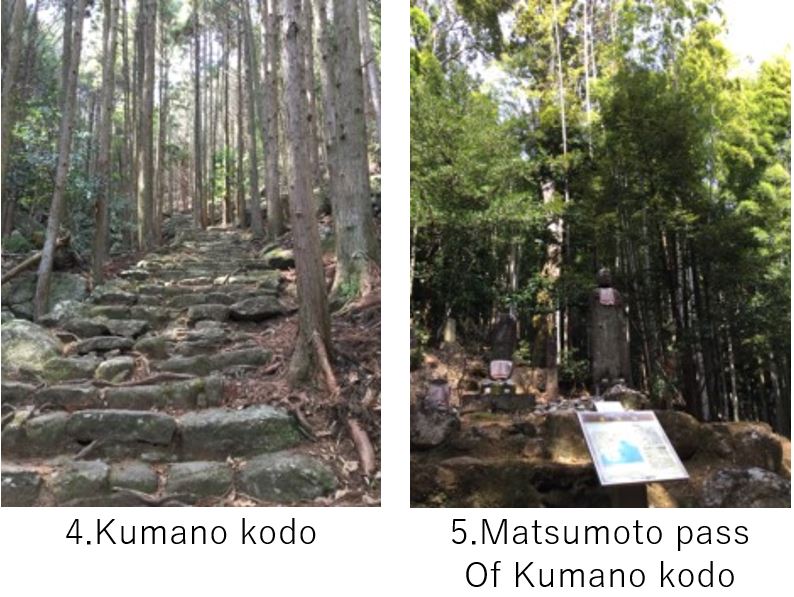
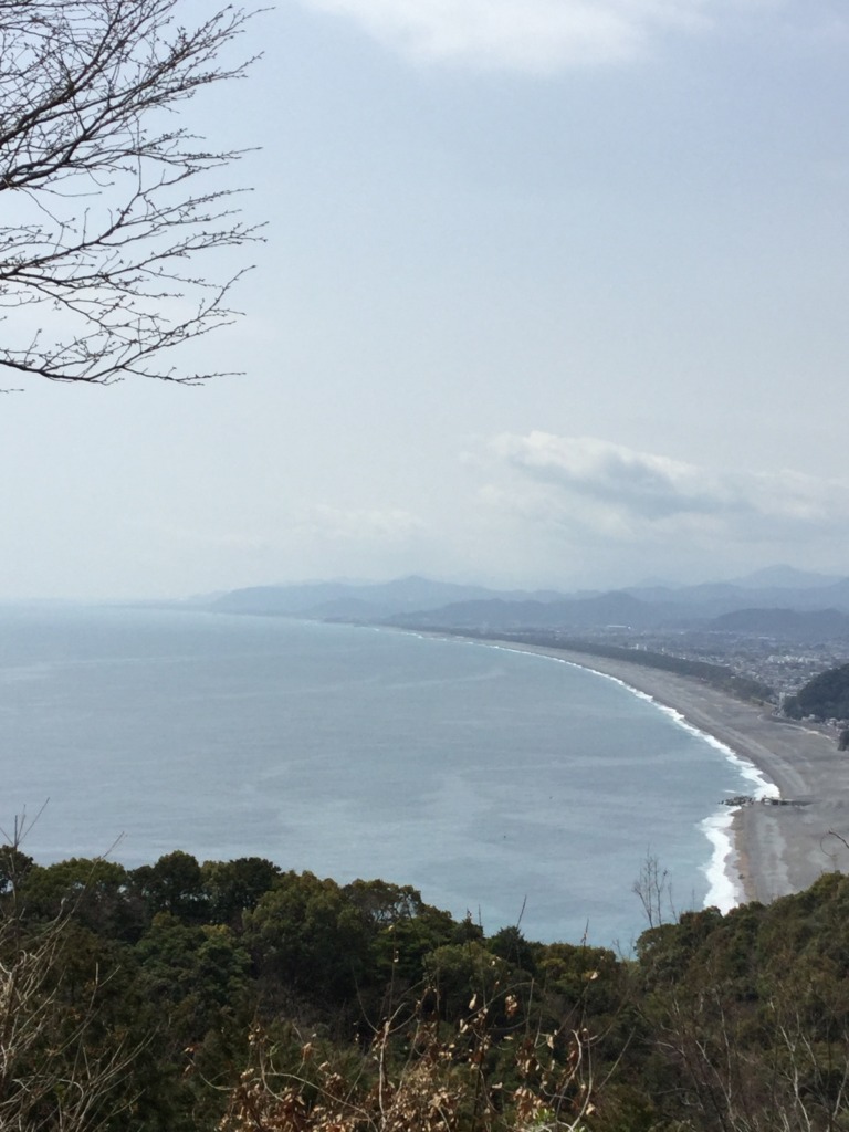
Up to Kumano city, 50km from Owase, I still could see Rias coast(pic.1), and clear beach like Atashika beach(pic.2,3). The Kumano kodo, ancient pilgrim roads connecting Ise Jingu(Pls refer to Day1 article) and today’s destination, Kumano Hongu, and other Buddhism temples seems running parallel with my route. The cross point of my route and Kumano kodo was just the cross point of Route 42 and my route(Route 311), where I parked my bike and climb the mountain by walk(pic.4).The air was very cool and felt sacred atmosphere.
At Matsumoto pass there was a deviation route toward “Azuma-ya", left side of the pass. Around 200m walk from that point took me to the observatory for Shichirimihama beach(pic.6). It was nice place and I wanted to heal my tired legs for a while, but the time was already noon. I climbed down to search lunch place.
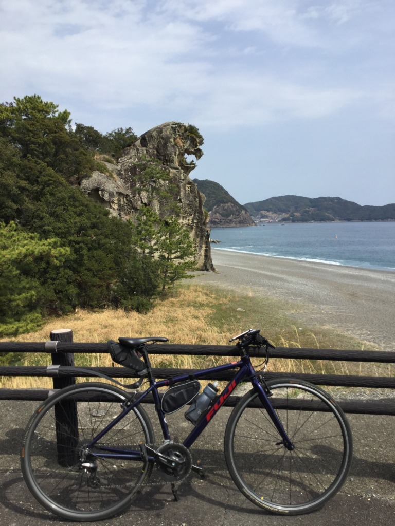
The tunnel for cars and pedestrian to go to Kumano are separated and bikes should go pedestrian tunnel which deviated from the coast. So after the tunnel it’s better to come back to Route 311 soon. There were some nice local restaurants but now a little tired with special meal, so I took very common first food, “Sukiya". In front of the Sukiya, I could see a photo point, Shishi-iwa which looks like Godzilla(pic.7).
The road from Kumano city(point pic.7) to Shingu city was very flat and road condition was also good. I’m relieved to gain over 20km without energy consumption. In Shingu city, there is Kumano Hayatama taisha which is one of 3 main shrines in Kumano. But I was afraid of reaching late at my final destination, I headed toward another main shrine, Kumano Hongu instead of Hayatama taisha.
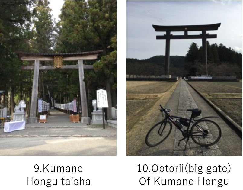
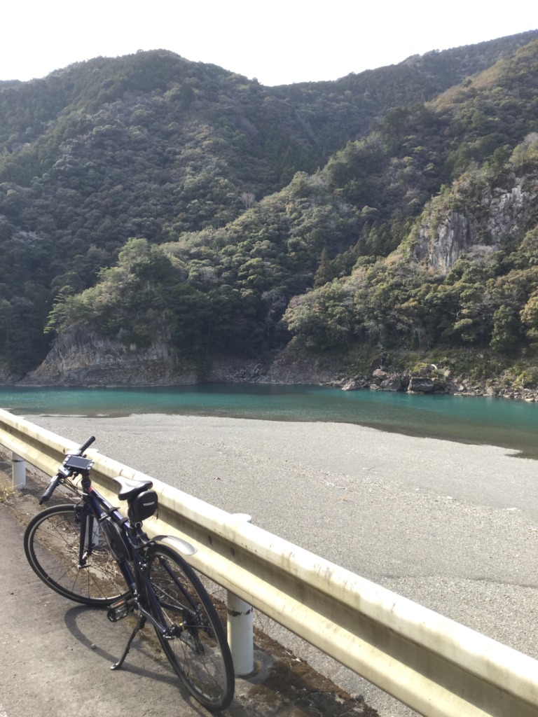
Along the Kumano river, I went up on Route 168. Against my expectation, the slope was not steep, rather, very easy to ride though big dump trucks often passed by. Sometimes the emerald green river can be seen(pic.8) and I could reach Hongu without fatigue(pic.9,10). Again taking picture seemed prohibited, so pls refer to the guide of Hongu.
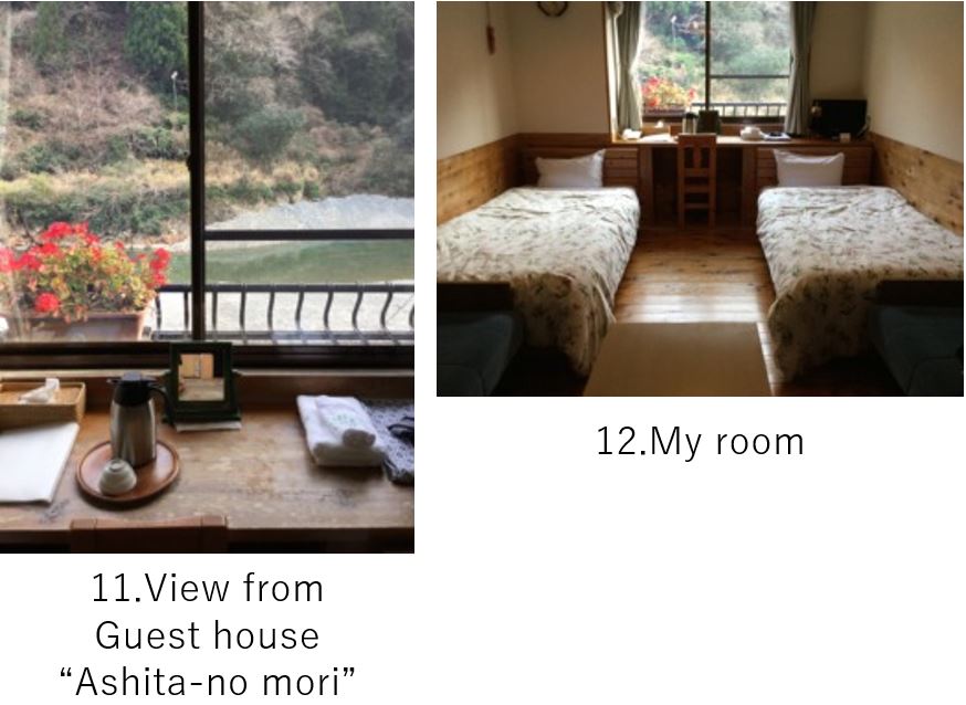
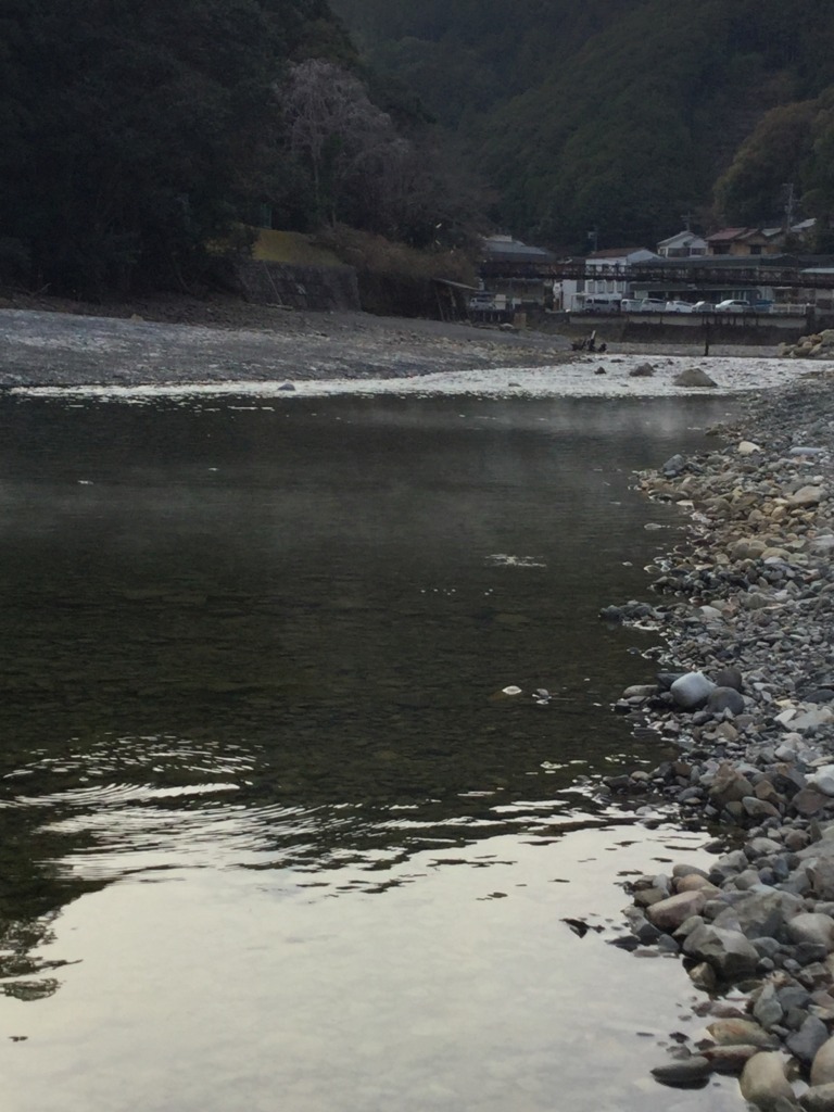
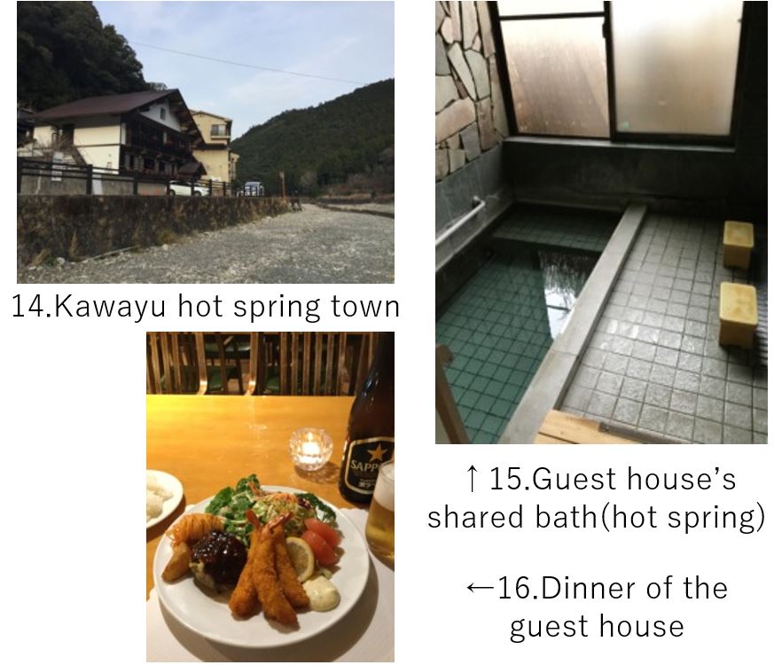
Today I stayed in Kawayu hot spring town(pic.14). “Kawa" means a river. “yu" means hot water. As its name suggests, hot springs spring up from the riverbed(pic.13). In the upstream, there is a spot to take a bath in the river. My guest house “Ashita-no mori" , run by family served normal Japanese western cuisine(pic.16) for dinner but taste as well as atmosphere was very nice. Further its shared hot spring(pic.15) was very cozy. (The guests take turn to use the bath room.) And the owner specially prepared Onigiri(rice balls) for me since I had to start very early in next morning due to weather forecast.
<Transportation info>
From Nagoya: Kintetsu Nagoya line 7:40AM → Ise Nakagawa 9:04AM, 9:06AM → Matsuzaka 9:12AM
Change to JR Kii line 9:24AM → Taki 9:35AM, 9:43AM → Owase12:00/Kumano-shi 12:46/Shingu 13:20 ¥3,930- *It requires half a day from Nagoya to this region by train.
<Other recommended spots near my route>
<Connection routes>
D-5(Day1): Ise to Owase city
D-5(Day3): Nachi shrine