Yonezawa to Oogawara town (B-3)⭐⭐ ‘22.18th,Sep
This B-3 route is in Area-B, “Tohoku". See Area-B map/See Japan map
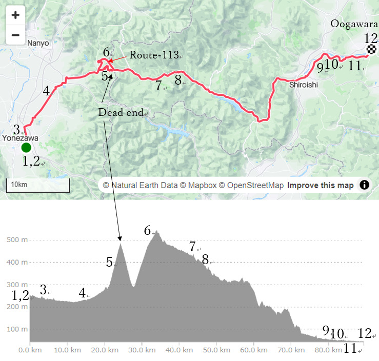
Sight & Entertainment ⭐⭐⭐
Foods & Drinks ⭐⭐ *Up to your plan. Yonezawa has lots of good cuisines
Easiness ⭐⭐⭐
Road condition ⭐⭐⭐
Safety ⭐⭐ *Many tunnels w/o pedestrian way from 30-40km & 50-70km
The reason I rode on this route was my duty to connect all of my route into one. So I’d not expected so much but I could feel nice rural atmosphere in some points. But the busy mountain road, Route-13 had many dangerous tunnels, which is the reason I don’t recommend this B-3 route.
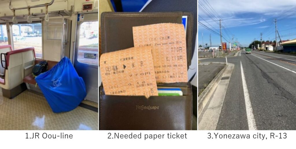
I woke up at 6:00AM in Fukushima city and got on 7:14AM departure JR Oou train toward Yonezawa. Since I drank too much in previous night (ref. article B-2), I had a little headache. As I wrote in “Notice" page, this line needed a paper ticket(pic.2) since every station in this line didn’t have auto ticket gate.
It was a rural city’s Sunday morning(8:30AM), so the starting was very easy cycling(pic.3).
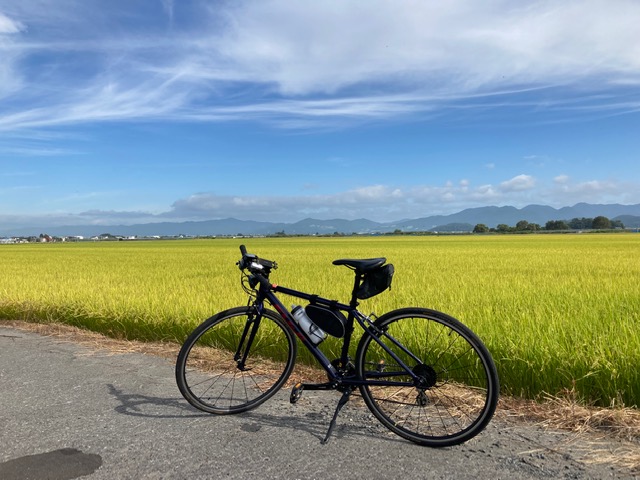
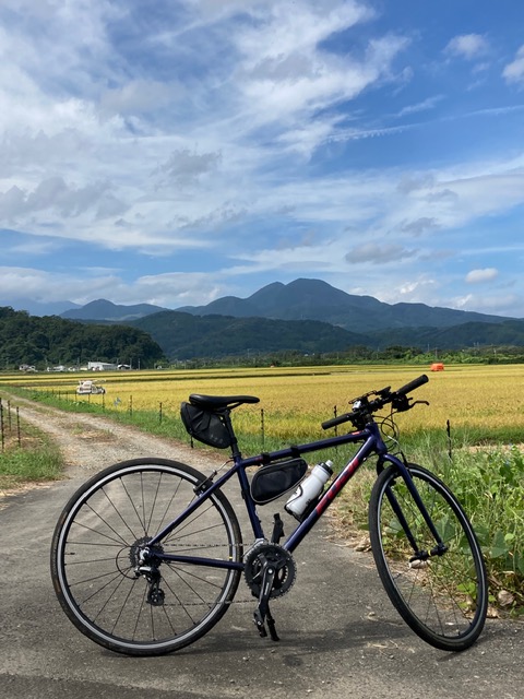
And just before entering mountains, I was mesmerized by golden shining paddy field(pic.4). Tohoku area is a famous production area for rice, so this wide, exquisite mixture of yellow and green colors impressed city people like me.
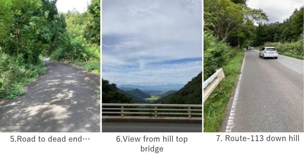
I could reach the mountain entrance much earlier than my plan but I took a big mistake there. To avoid long tunnels in Route-113 which didn’t seem to have pedestrian way, I chose a local meandering narrow road. I was afraid of encountering a bear so I shouted all the hill climbing toward the pass(pic.5). It was just 400m toward junction with R-113 when I reached the dead end. I couldn’t believe the situation but no other way to go back. I lost about 30min. Eventually I took R-113 and started hill climbing again. As the front gear was broken, it was tough but fortunately I came to the top in 200m climbing(pic.6).
From there to Oogawara city, it was basically down hill. There were less spaces for cycling but thanks to week end, not so many trucks passed by, so I didn’t feel stress.
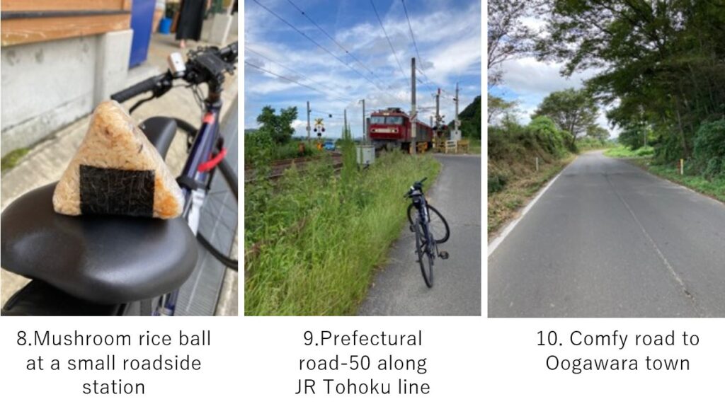
At 10:45AM, I reached a small road side station and I bought a handmade local rice ball(pic.8). It seemed that this area promoted appeal of Soba though I didn’t feel like eating that in this time.
Again the moderate down hill continued up to Shiroishi city. On the way, there were many tunnels but most of them didn’t have pedestrian ways. Sometimes I rode on a narrow gutter, which scared me so much.
From Shiroishi city to Oogawara station, I took a local prefectural road along JR line and Shiroishi river. Unexpectedly the road was well paved, had nice rural view, and few cars were running, so I just recommend only this section for cycling in this B-3 route(pic.9~11).
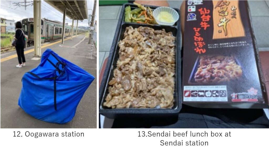
The Oogawara town and its station was desolate. But I got on a train here(pic.12) to catch 2:57PM Shinkansen from Sendai station. Still I had much time in Sendai station, I ate Sendai beef lunch box(pic.13). It was enough delicious for lunch box(around \1200-).
<Transportation info>
1st train from Fukushima to Yonezawa: AM7:14 JR Oou line →AM8:00 Yonezawa , \770-
Sendai to Tokyo(my case): 2:57PM Hayabusa No.26 Ueno station at 4:26PM \11,200-
<Other recommendable spots near my route>
Iisaka hot spring (10km north of Fukushima city) , there are many hot springs near this route.
<Connection route>