Nishi Izu skyline cycling(D-18)⭐⭐⭐ ‘25.3rd,Nov.
This route D-18 is in Area-D, “Tokai". See Area-D map/ See Japan map
Sight & Entertainment ⭐⭐⭐⭐
Food & Drinks ⭐⭐⭐*Up to plan. I didn’t have time to have dinner in this time
Easiness ⭐⭐
Road conditions ⭐⭐⭐
Safety ⭐⭐
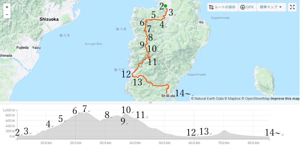
This route was the last piece for completing Izu peninsla one round but I waited for the timing for many years since the route seemed the best one to take a good picture of Mt.Fuji with Suruga bay. There were 3 days holiday from 1st Nov to 3rd, and the weather seemed fine on 3rd, I decided on 1st to go on 3rd.
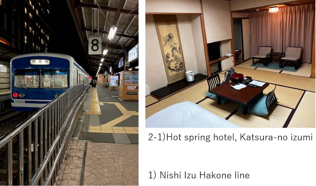
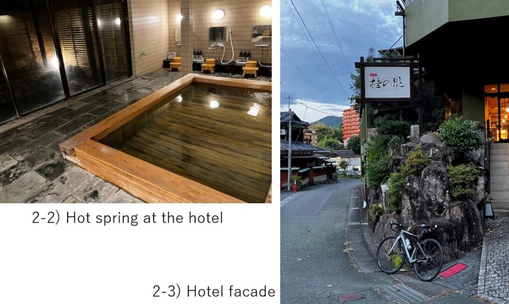
To take a good Mt.Fuji view, I should be on the ridge of Izu mountain in early morning. So I moved on 2nd evening to the starting point, Izu Nagaoka town. This town is famous for hot spring, so I booked a hotel with a hot spring bath, Katusra-no Izumi(pic.2). This bath is reserved for each guest for a set time, which is the reason I could take a pic of the bath(pic2-2).
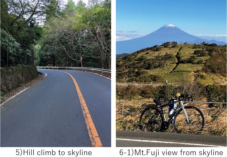
I started at AM6:00 on 3rd. Cycling toward South along the Kano river for 5km(pic.3), then started hill climbing toward West.
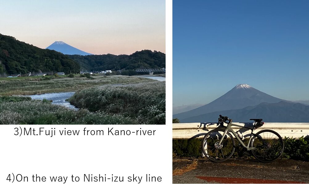
Sometimes I could see Mt.Fuji from the road(pic.4) but basically the rode was shrouded by trees(pic.5) and could not see Mt.Fuji. The angle ave. was around 5-6% but I felt tough this time.
I reached the view point on Nishi-Izu skyline at AM8:00. As I expected, Mt. Fuji could be seen very clearly(pic.6). But unfortunately the wind on the ridge was too strong and I was very much scared since not only steering but also the bike itself seemed caught by the wind. I thought I should not continue cycling on the ridge anymore due to the danger.
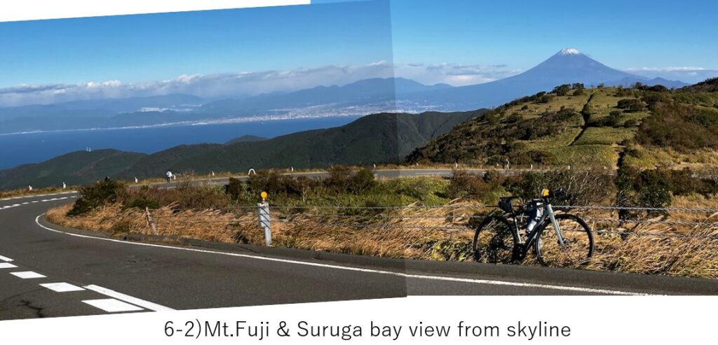
After pushing the bike for a few hunderd meters and coming to the opotite site of the ridge(East side of the ridge), wind seemed weakened and the road seemed to run on East side, I decided to continue cycling(pic.7). Without the wind, the road was very nice for cycling.
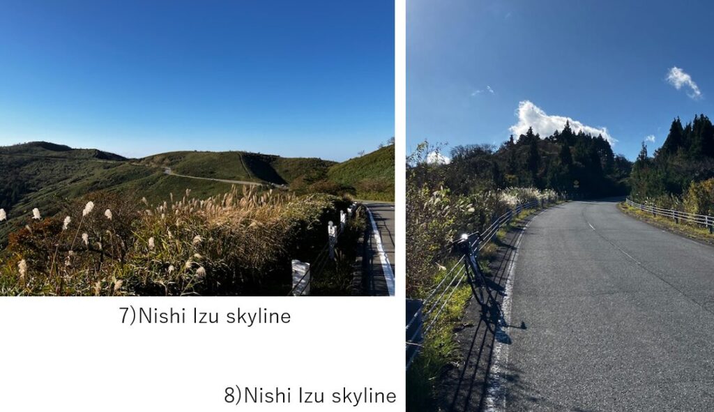
There were a few big up and down before reaching Kazehaya pass(pic.9). As the name suggests, the strong wind passed through the pass. ”Kaze" is wind and “haya" means swift. But the Suruga bay view was very beautiful.
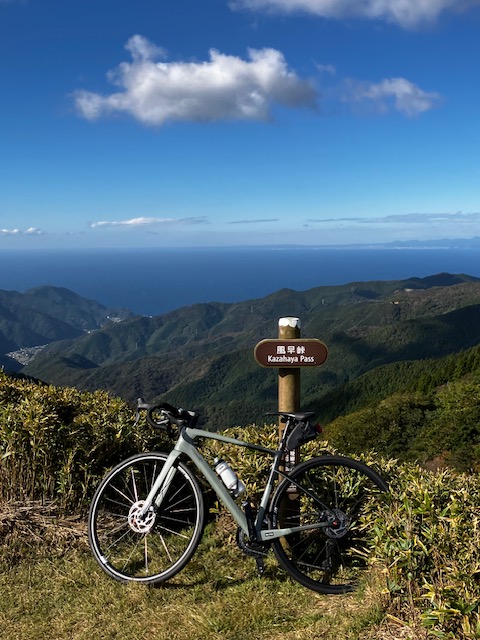
I felt fed up with the steep slope ahead from Kazehaya pass but resumed cycling toward the last peak, Nishina pass. It took 20min to reach Nishina pass and I got weary. The time was AM9:30.
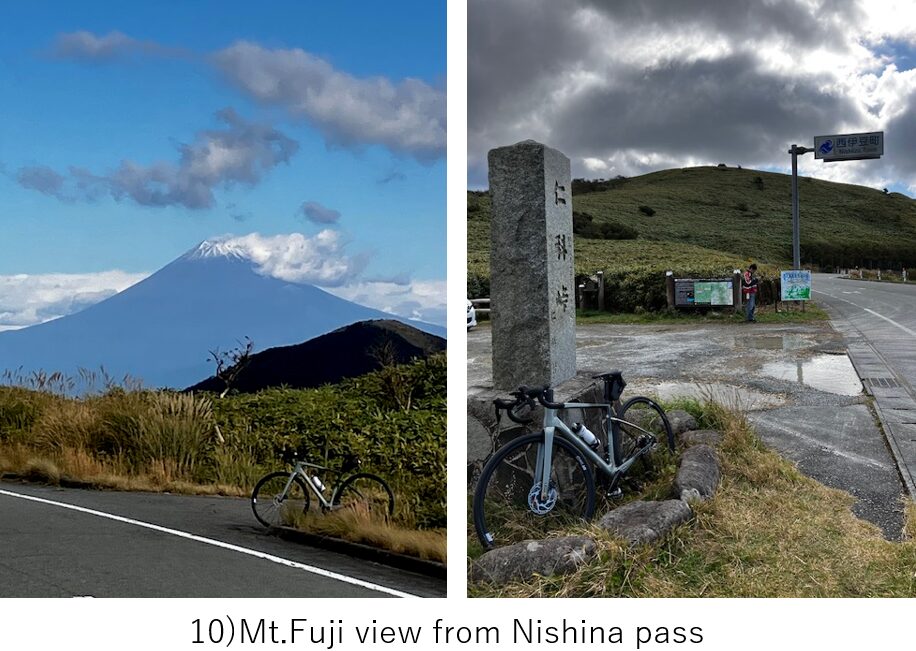
From this point too, I could see good Mt.Fuji view though Suruga bay could not be seen(pic.10). There was a walking way to top of the hill from this point but I didn’t have willpower.
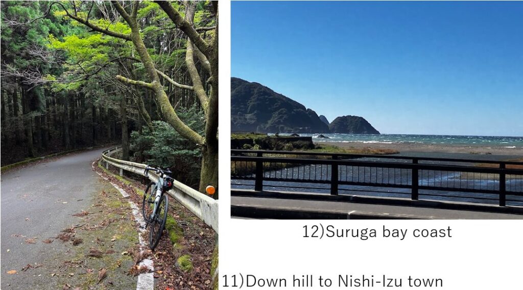
After taking a rest for a while, I resumed. Fortunately only down hill was remained. The road was narrow and many wet autumn leaves were scattered on the road, so I could not speed up(pic.11). And it lasted for 15km, my calculation got off. I thought I could catch 13:02 express from Izukyu-Shimoda but with this slow down hill, it became difficult to reach before that time in case I take R-136 via Minami-Izu town.
So after reaching the coast(pic.12) at Nishi-Izu town, I quickly turned left at Matsuzaki town on prefectural R-15(pic.13). This was the shortcut to Shimoda city.
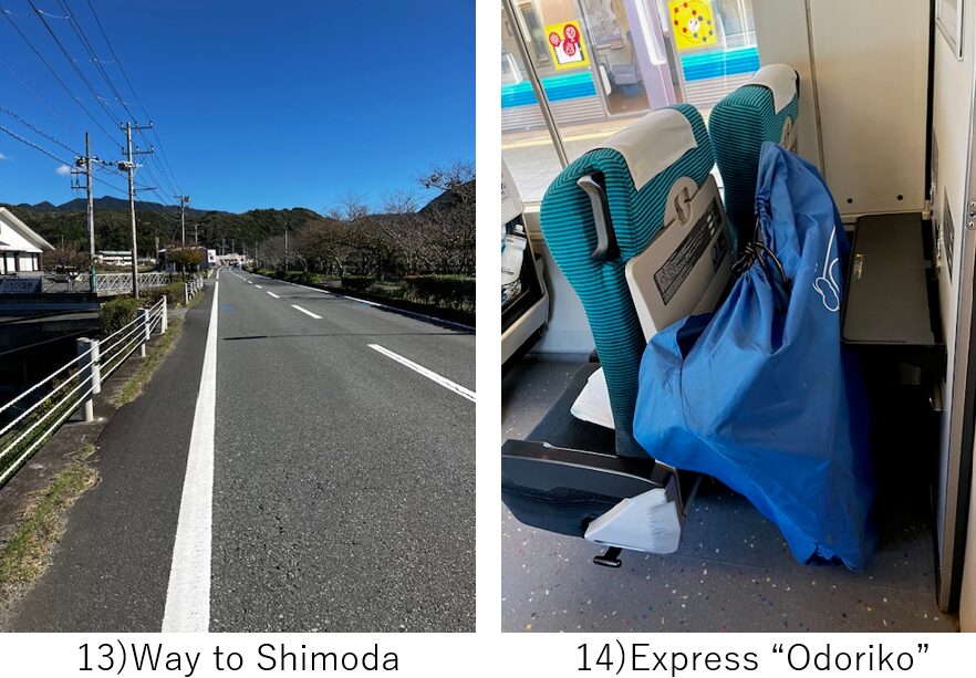
Luckily I could reach Izukyu-Shimoda station around PM12:30. To reach my home as early as possible, I got on a Odoriko express to Atami and took Shinkansen to Tokyo.

On the train I enjoyed a local lunch box in which there was a grilled golden eye snapper, famous in this region(pic.15).
<Transportation info>
From Tokyo to IzuNagaoka: Shinkansen Hikari to Mishima, then change to Izuhakone line for 20min, total around 1.5hrs with \4,430-
From Izukyu-Shimoda to Tokyo: Fastest way in my case was PM1:02 Odoriko express No.6 to Atami at PM2:28, then PM2:35 Shinkansen, “Kodama No.722" to Tokyo PM3:18. TTL \7,320-
<Other recommendable spots near my route>
Nirayama city, world heritage site
<Connected routes>
D-3: Amagi pass climbing