Atsumi peninsula cycling(D-19)⭐⭐⭐’26.22nd,Feb
This route D-19 is in Area-D “Tokai". See Area-D map/ See Japan map
Sight & Entertainment ⭐⭐⭐
Food & Drinks ⭐⭐⭐
Easiness ⭐⭐⭐
Road conditions ⭐⭐
Safety ⭐⭐
We had 3days holidays in this week in Japan and since I had to visit my father’s grave in Shizuoka, I’d planned to go cycling to Atsumi peninsula next day where I’d wanted to visit someday.
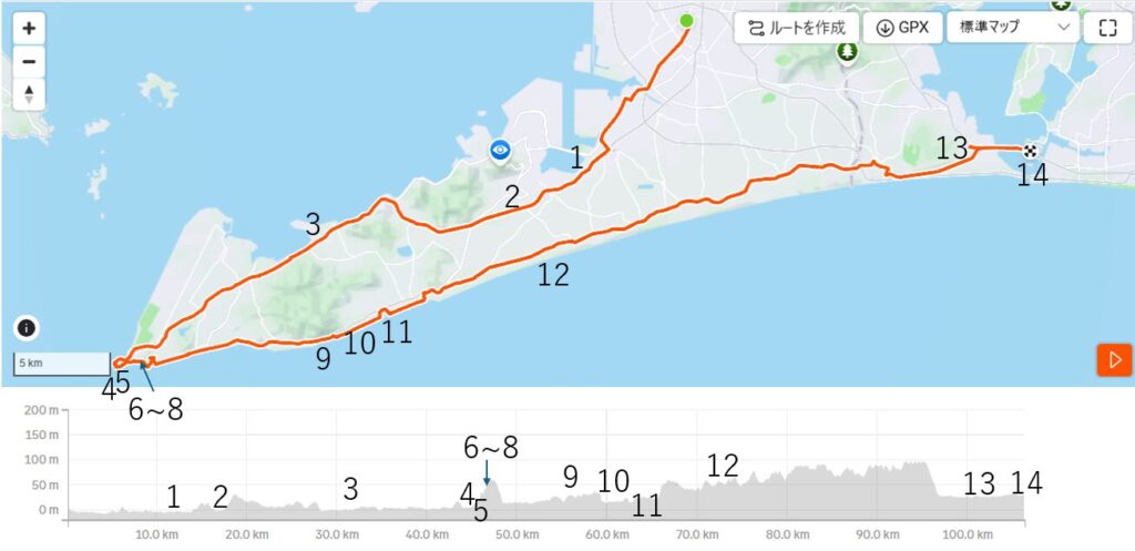
After parking my car at Benten-jima , I was on board JR train to Toyohashi where I started cycling toward the peninsula at 9:00AM. The route toward the tip of the peninsula was a little boring(pic.1~3). But I noticed there were many cabbage patches along the road(pic.2), by which I remembered I found many Aichi prefecture’s cabbage in my home town stores.
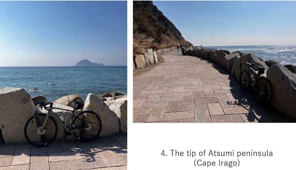
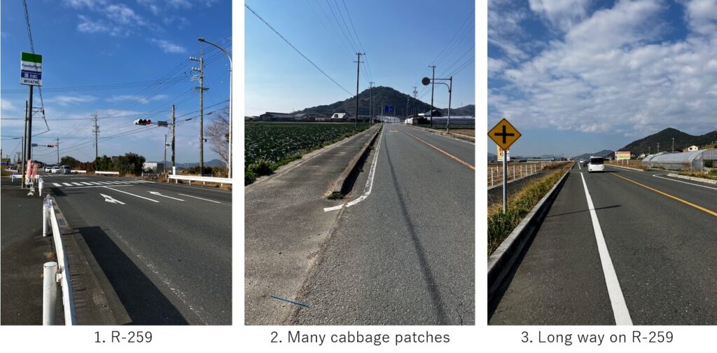
Unexpectedly East wind blew and I could easily reach cape Irago, the tip of peninsula within 2 hours. It seemed a good timing to take a lunch before congestion. There were some local restaurants which served shells, so I entered one of that and ordered a clam lunch set(pic.5). This area seemed very famous for clams but recently it seemed poor catch of them.
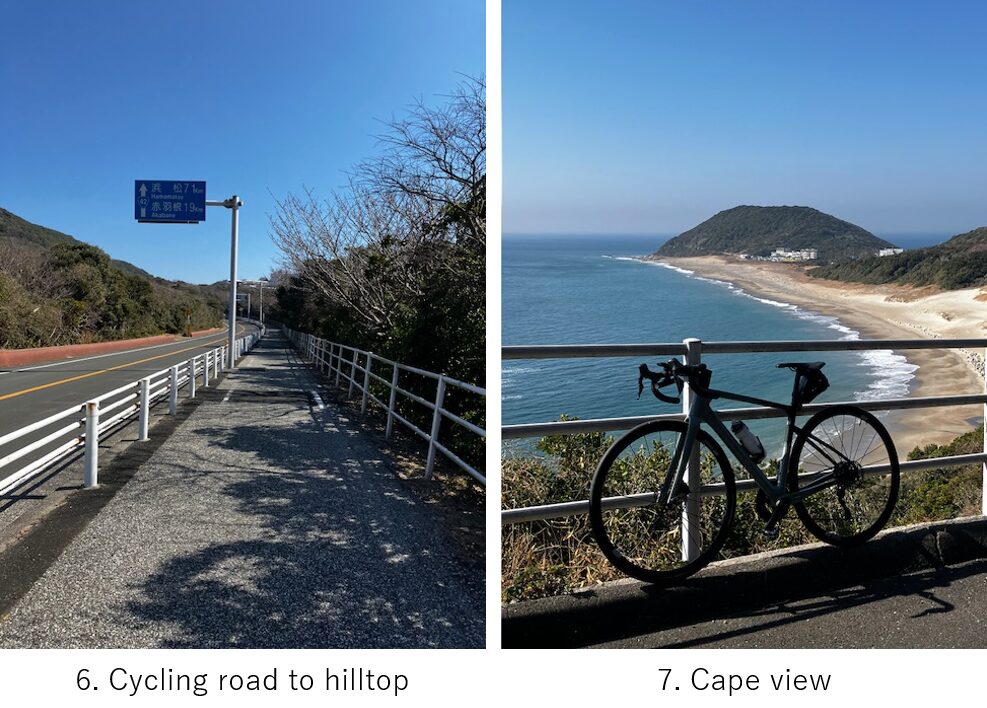
I resumed cycling at 11:40AM. It began with a short hill climbing(pic.6), but gave me a good view point of the tip(pic.7).
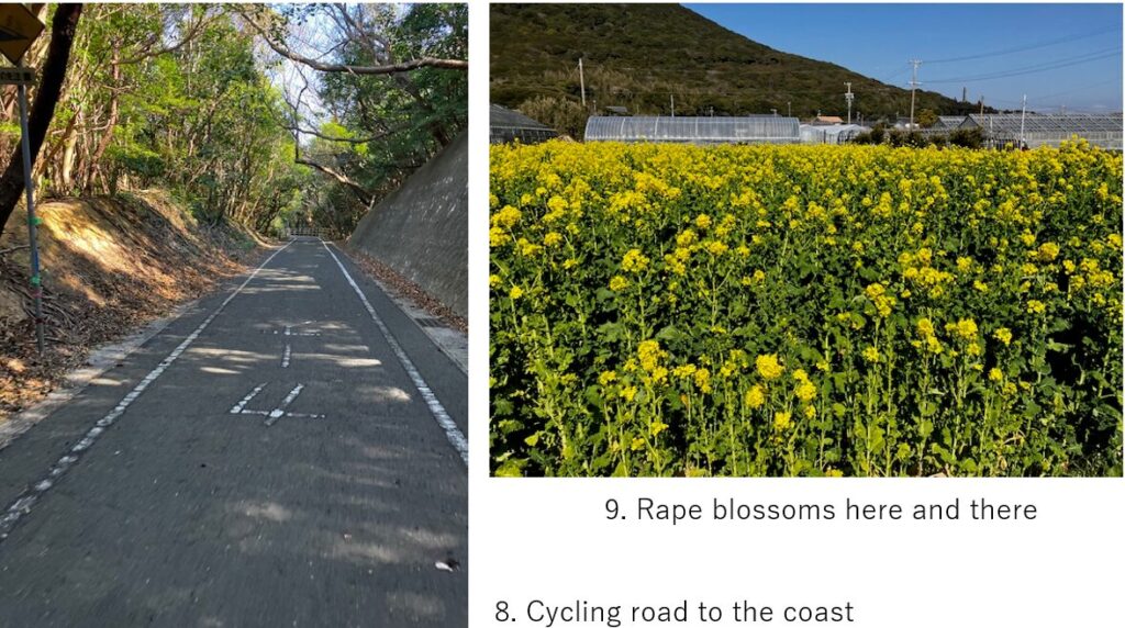
From this point, there seemed a long cycling road(pic.8). So many cyclists were doing the same. And it was a good season for rape blossoms. There was a good rape garden, “Irago Nanohana garden" near the cycling road, along R-42, but I missed that… Instead I could see some blossoms here and there(pic.9).
Sometimes the cycling road ran on the coast(pic.10), but some roads were well paved and some are not. Besides the strong East wind became the head wind in this direction. So gradually I wanted to avoid the coast side cycling road.
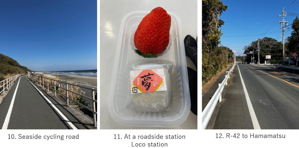
After 1 hour cycling, I felt tired and dropped in the roadside station, Loco station to find a fruit since I found many melon field and strawberry field along the road as well as cabbage patches. There I could find a big strawberry(pic.11).
After resuming around 13:00, I took mainly on R-42 toward Hamamatsu(pic.12). Unexpectedly the road repeated up and down and I felt the uphill was dominant, which I was convinced by seeing my log afterward. The route was on the 100M hight plateau which was different from my image, just cycling along the coast flat road.
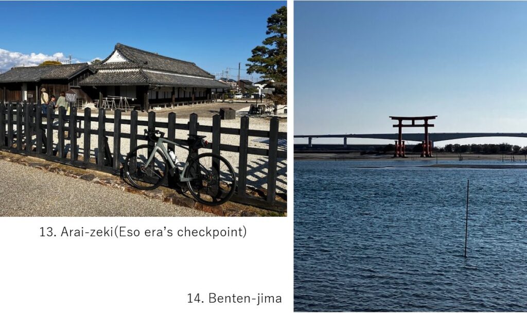
Just before 10km to goal, the road came to the sea level. Before arriving at Benten-jima, I dropped in Arai-zeki, Edo era’s checkpoint, though I didn’t enter it. I had to drive back to Chiba prefecture, which took 6 hours.
<Recommendable spots near my route>
<Connected routes>
D-9: Nagoya to Toyohashi
D-13: Hamanko-lake cycling